Borken - Borken-hoxfeld
Airport details
| Country | Germany |
| State | North Rhine-Westphalia |
| Region | ED |
| Airspace | Langen Ctr |
| Municipality | Borken |
| Elevation | 157ft (48m) |
| Timezone | GMT +1 |
| Coordinates | 51.85333, 6.81483 |
| Magnetic var | |
| Type | land |
| Available since | X-Plane v10.32 |
| ICAO code | EDLY |
| IATA code | n/a |
| FAA code | n/a |
Communication
| Borken-Hoxfeld Hoxfeld Info | 122.925 |
Nearby Points of Interest:
St. Gudula
-St. Andreas
-Plekenpol
-Strandbad Winterswijk
-De Meesterkok
-Synagoge (Winterswijk)
-Monument Nederland Neutraal 1914-1918
-Watertoren Winterswijk
-Spoelerij (De Tricotfabriek)
-Grenspaal 171
-Walfortlaan 3, Bredevoort
-De Vinkenburg
-'t Meestershuus
-Hozenstraat 16, Bredevoort
-Synagoge
-Boterfabriek
-Humberghaus
-'t Zand 2, Bredevoort
-Walfort
-Markt 7, Bredevoort
-Boeijink
-Huis van Nijman
-Markt 1, Bredevoort
-Markt 10
-Sint-Georgiuskerk, Bredevoort
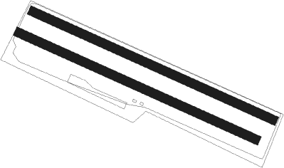
Runway info
Runway 12L / 30R  | ||
| length | 856m (2808ft) | |
| bearing | 109° / 289° | |
| width | 30m (98ft) | |
| surface | grass | |
| Runway 12 / 30 | ||
| length | 844m (2769ft) | |
| bearing | 109° / 289° | |
| width | 30m (98ft) | |
| surface | grass | |
Nearby beacons
| code | identifier | dist | bearing | frequency |
|---|---|---|---|---|
| RKN | DME | 16.9 | 350° | 116.80 |
| BOT | BOTTROP NDB | 17.8 | 142° | 406 |
| LAA | NIEDERRHEIN NDB | 28.2 | 249° | 352 |
| NID | DME | 29.3 | 249° | 115.50 |
| LI | DUESSELDORF NDB | 30.5 | 171° | 417 |
| LMA | LIMA NDB | 32.9 | 221° | 311 |
| HMM | HAMM VOR/DME | 33.1 | 90° | 115.65 |
| BAM | BARMEN VOR/DME | 34.3 | 145° | 114 |
| DUS | DUESSELDORF VOR/DME | 34.3 | 186° | 115.15 |
| DOR | WICKEDE (DORTMUND) VOR/DME | 36.2 | 112° | 108.65 |
| DWI | DORTMUND-WICKEDE NDB | 36.2 | 112° | 357 |
| MOD | DME | 36.5 | 72° | 114.05 |
| DLN | DEELEN TACAN | 36.9 | 282° | 112.20 |
| DY | DUESSELDORF NDB | 37.6 | 195° | 284 |
| MHV | MOENCHENGLADBACH VOR | 38.9 | 208° | 109.80 |
| MHD | DME | 39 | 208° | 112.50 |
| MYN | MUENSTER/OSNABRUECK NDB | 40.7 | 73° | 371 |
| WYP | WIPPER VOR | 51.3 | 150° | 109.60 |
| LJ | COLOGNE-BONN NDB | 56.3 | 165° | 365 |
| LW | COLOGNE-BONN NDB | 59.6 | 155° | 300 |
| GIX | GEILENKIRCHEN TACAN | 60.7 | 221° | 108.10 |
| KBO | COLOGNE-BONN VOR/DME | 60.8 | 162° | 112.15 |
| NW | MAASTRICHT NDB | 61.1 | 228° | 373 |
| MAS | MAASTRICHT VOR/DME | 61.8 | 224° | 108.60 |
Disclaimer
The information on this website is not for real aviation. Use this data with the X-Plane flight simulator only! Data taken with kind consent from X-Plane 12 source code and data files. Content is subject to change without notice.