Bad Sassendorf - Soest Bad Sassendorf
Airport details
| Country | Germany |
| State | North Rhine-Westphalia |
| Region | ED |
| Airspace | Langen Ctr |
| Municipality | Bad Sassendorf |
| Elevation | 394ft (120m) |
| Timezone | GMT +1 |
| Coordinates | 51.57806, 8.21472 |
| Magnetic var | |
| Type | land |
| Available since | X-Plane v10.40 |
| ICAO code | EDLZ |
| IATA code | n/a |
| FAA code | n/a |
Communication
Nearby Points of Interest:
Saint Nicholas Church
-Haus Sassendorf
-Villa Plange
-Rathaus Soest
-Gaststätte Am Kleinbahnhof
-Französische Kapelle
-St. Martin
-Altes Rathaus Erwitte
-Schloss Erwitte
-St. Antonius (Stocklarn)
-Jüdischer Friedhof
-Synagogue Lippstadt
-St. Pankratius
-Maria Magdalena
-Alte Seilerei Hartmann
-St. Johannes Baptist
-Schloss Eringerfeld
-St. Nikolaus
-Haus Koeningen
-St. Joseph
-Werl Prison
-Amtsgericht Werl
-Johanneskirche
-Marienhospital Arnsberg
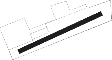
Runway info
| Runway 06 / 24 | ||
| length | 792m (2598ft) | |
| bearing | 77° / 257° | |
| width | 40m (131ft) | |
| surface | grass | |
Nearby beacons
| code | identifier | dist | bearing | frequency |
|---|---|---|---|---|
| PAD | DME-ILS | 15.1 | 85° | 108.50 |
| PAD | PADERBORN-LIPPSTADT NDB | 16 | 84° | 354 |
| DWI | DORTMUND-WICKEDE NDB | 21.8 | 265° | 357 |
| DOR | WICKEDE (DORTMUND) VOR/DME | 22 | 265° | 108.65 |
| HMM | HAMM VOR/DME | 25.2 | 299° | 115.65 |
| GMH | GERMINGHAUSEN VOR/DME | 27.3 | 218° | 115.40 |
| WRB | WARBURG VOR/DME | 33.7 | 95° | 113.70 |
| OSB | OSNABRUCK TACAN | 37.4 | 6° | 108.35 |
| OSN | OSNABRUECK VOR | 37.4 | 6° | 114.30 |
| MYN | MUENSTER/OSNABRUECK NDB | 38.1 | 324° | 371 |
| MOD | DME | 38.9 | 317° | 114.05 |
| WYP | WIPPER VOR | 47.3 | 240° | 109.60 |
| SLD | DME | 52.5 | 189° | 108.05 |
| COL | COLA VOR/DME | 53.1 | 218° | 108.80 |
| BYC | BUECKEBURG NDB | 53.7 | 51° | 368 |
| SIL | SIEGERLAND NDB | 54 | 185° | 489 |
| LW | COLOGNE-BONN NDB | 54.5 | 235° | 300 |
| LV | COLOGNE-BONN NDB | 59.2 | 232° | 327 |
Disclaimer
The information on this website is not for real aviation. Use this data with the X-Plane flight simulator only! Data taken with kind consent from X-Plane 12 source code and data files. Content is subject to change without notice.