Illertissen
Airport details
| Country | Germany |
| State | Bavaria |
| Region | ED |
| Airspace | Munich Ctr |
| Municipality | Illertissen |
| Elevation | 1679ft (512m) |
| Timezone | GMT +1 |
| Coordinates | 48.23528, 10.13778 |
| Magnetic var | |
| Type | land |
| Available since | X-Plane v10.40 |
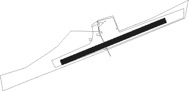
| ICAO code | EDMI |
| IATA code | n/a |
| FAA code | n/a |
Communication
| Illertissen Illertissen Info | 118.525 |
Nearby Points of Interest:
rectory
-Altes Rathaus
-Mariä Geburt
-St. Petrus von Alcantara
-Pfarrkirche St. Michael
-Pfarrhaus Breitenthal (Schwaben)
-St. Johannes Baptista
-Gänsberg 2 (Babenhausen)
-Kerkerkapelle
-Ehemaliges Mesnerhaus
-Frauenstraße 1
-Kriegergedächtniskapelle (Nattenhausen)
-Bildstock (Winterrieden)
-Pfarrhaus
-Feldkapelle an der Babenhauser Straße
-Feldkapelle an der B300
-Bildstock
-Ölbergkapelle
-Mühle
-Kapelle
-Kreuzweg Kirchhaslach
-Ölbergkapelle (Kirchhaslach)
Nearby beacons
| code | identifier | dist | bearing | frequency |
|---|---|---|---|---|
| LUP | LAUPHEIM NDB | 9.1 | 266° | 407 |
| ALG | ALLGAEU (MEMMINGEN) NDB | 15.1 | 152° | 341 |
| ALD | (MEMMINGEN/ALLGAU) DME | 15.2 | 159° | 117.20 |
| LCH | LECHFELD TACAN | 28.9 | 94° | 108.80 |
| KPT | KEMPTEN VOR/DME | 30.6 | 157° | 108.40 |
| AGB | AUGSBURG NDB | 33.7 | 77° | 318 |
| AUG | DME | 33.9 | 77° | 115.90 |
| TGO | TANGO TACAN | 41.8 | 294° | 112.50 |
| FHD | DME | 42.5 | 228° | 112.60 |
| WLD | WALDA VOR/DME | 44.6 | 71° | 112.80 |
| STG | STUTTGART VOR/DME | 44.7 | 298° | 116.85 |
| SGD | DME | 45.4 | 296° | 115.45 |
| LBU | LUBURG VOR/DME | 51.5 | 310° | 109.20 |
| DKB | DINKELSBUEHL VORTAC | 54.6 | 6° | 117.80 |
| SHD | HALL DME | 54.8 | 338° | 108.05 |
Disclaimer
The information on this website is not for real aviation. Use this data with the X-Plane flight simulator only! Data taken with kind consent from X-Plane 12 source code and data files. Content is subject to change without notice.