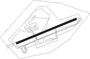
Jesenwang
Airport details
| Country | Germany |
| State | Bavaria |
| Region | ED |
| Airspace | Munich Ctr |
| Municipality | Jesenwang |
| Elevation | 1858ft (566m) |
| Timezone | GMT +1 |
| Coordinates | 48.17433, 11.12500 |
| Magnetic var | |
| Type | land |
| Available since | X-Plane v10.40 |
| ICAO code | EDMJ |
| IATA code | n/a |
| FAA code | n/a |
Communication
| Jesenwang Jesenwang Info | 122.425 |
Nearby Points of Interest:
Marienmonument
-Pfarrhaus
-Schloss Grunertshofen
-Ehemalige Schmiede
-Augsburger Straße 3
-St. Jakob (Mammendorf)
-Steinbach 37 (Moorenweis)
-Bauernhaus
-Dorfstraße 12 (Nannhofen)
-Dorfstr.16 (Kottgeisering)
-Schmiede (Kottgeisering)
-St. Rasso
-Mariä Heimsuchung
-Pfarrhaus (Schöngeising)
-Zellhofstraße 1
-Kloster Spielberg
-Dünzelbach 50
-St. Cajetan (Oberschweinbach)
-Schloss Spielberg
-St. Vitus (Zellhof)
-Pfarrhaus (Hausen b. Geltendorf)
-Burgstall Engelsberg
-Torhaus
-Silbersteg
-Sühnekreuz
Nearby beacons
| code | identifier | dist | bearing | frequency |
|---|---|---|---|---|
| OBI | OBERPFAFFENHOFEN NDB | 8.5 | 120° | 429 |
| MAH | MAISACH VOR/DME | 9.1 | 65° | 115.20 |
| LCH | LECHFELD TACAN | 10.6 | 273° | 108.80 |
| AGB | AUGSBURG NDB | 16.8 | 322° | 318 |
| AUG | DME | 16.8 | 323° | 115.90 |
| MSE | MUNICH NDB | 23.1 | 73° | 358 |
| WLD | WALDA VOR/DME | 24.3 | 1° | 112.80 |
| MNE | MUNICH NDB | 24.5 | 72° | 369 |
| OTT | OTTERSBERG VOR/DME | 27.6 | 89° | 112.30 |
| DMS | DME | 27.9 | 76° | 115 |
| DMN | DME | 29.1 | 74° | 116 |
| MIQ | MIKE NDB | 30.3 | 50° | 426 |
| NEU | NEUBURG TACAN | 32.5 | 9° | 108.90 |
| MSW | MUNICH NDB | 32.9 | 77° | 400 |
| MNW | MUNICH NDB | 33.7 | 76° | 338 |
| ALG | ALLGAEU (MEMMINGEN) NDB | 36.2 | 258° | 341 |
| IGL | INGOLSTADT TACAN | 37.1 | 39° | 111.40 |
| ALD | (MEMMINGEN/ALLGAU) DME | 37.5 | 258° | 117.20 |
| IGL | INGOLSTADT NDB | 39.6 | 43° | 345 |
| KPT | KEMPTEN VOR/DME | 40.4 | 241° | 108.40 |
| RTT | RATTENBERG NDB | 55.4 | 132° | 303 |
| RUM | RUM NDB | 55.6 | 159° | 320 |
| INN | INNSBRUCK NDB | 57.8 | 164° | 420 |
| PAT | DME | 59.5 | 161° | 112 |
| DKB | DINKELSBUEHL VORTAC | 67.9 | 318° | 117.80 |
Disclaimer
The information on this website is not for real aviation. Use this data with the X-Plane flight simulator only! Data taken with kind consent from X-Plane 12 source code and data files. Content is subject to change without notice.