Landshut - Landshut - Ellermühle
Airport details
| Country | Germany |
| State | Bavaria |
| Region | ED |
| Airspace | Munich Ctr |
| Municipality | Landshut |
| Elevation | 1312ft (400m) |
| Timezone | GMT +1 |
| Coordinates | 48.51167, 12.03333 |
| Magnetic var | |
| Type | land |
| Available since | X-Plane v10.40 |
| ICAO code | EDML |
| IATA code | n/a |
| FAA code | n/a |
Communication
| Landshut - Ellermühle Landshut Info | 129.800 |
Nearby Points of Interest:
Pfarrkirche Peter und Paul
-Katholische Pfarrkirche Jakobus der Ältere
-Burgstall Eugenbach
-Filialkirche
-Mariä Heimsuchung (Altdorf)
-St. Vitus (Gammelsdorf)
-St. Ulrich (Dürnseiboldsdorf)
-Rathaus Moosburg an der Isar
-Mariensäule
-Saalkirche
-Annabergweg 11
-Palace Etzdorf
-Schulhaus
-Landschaftshaus
-Haus zum Kronprinzen
-Wasserturm in der Art eines mittelalterlichen Stadtturms
-Palais Pettenkofer
-Kirchgasse 239
-Spital Heilig Geist
-Neustadt 480, 480a, 480b
-Adelspalais
-Franziskanerkloster Landshut
-Dominikanerkloster (Landshut)
-Stethaimerstraße 29 (Landshut)
-Hofgarten
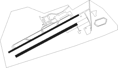
Runway info
Runway 07 / 25  | ||
| length | 1015m (3330ft) | |
| bearing | 74° / 254° | |
| width | 20m (66ft) | |
| surface | asphalt | |
| displ threshold | 62m (203ft) / 59m (194ft) | |
| Runway 06 / 24 | ||
| length | 873m (2864ft) | |
| bearing | 74° / 254° | |
| width | 30m (98ft) | |
| surface | grass | |
Nearby beacons
| code | identifier | dist | bearing | frequency |
|---|---|---|---|---|
| MNW | MUNICH NDB | 9.5 | 221° | 338 |
| MSW | MUNICH NDB | 10.8 | 219° | 400 |
| DMN | DME | 12.9 | 239° | 116 |
| DMS | DME | 14.4 | 236° | 115 |
| MNE | MUNICH NDB | 17 | 246° | 369 |
| MIQ | MIKE NDB | 17.6 | 278° | 426 |
| MSE | MUNICH NDB | 18.5 | 245° | 358 |
| IGL | INGOLSTADT NDB | 20.5 | 300° | 345 |
| OTT | OTTERSBERG VOR/DME | 21.6 | 213° | 112.30 |
| IGL | INGOLSTADT TACAN | 22.1 | 294° | 111.40 |
| MAH | MAISACH VOR/DME | 32.4 | 251° | 115.20 |
| NEU | NEUBURG TACAN | 34.8 | 284° | 108.90 |
| WLD | WALDA VOR/DME | 36.1 | 274° | 112.80 |
| RDG | RODING VOR/DME | 37.2 | 43° | 114.70 |
| OBI | OBERPFAFFENHOFEN NDB | 39.5 | 240° | 429 |
| HFX | HOHENFELS NDB | 42.9 | 346° | 286 |
| SBG | SALZBURG VOR/DME | 45.9 | 121° | 113.80 |
| SBG | SALZBURG NDB | 47.4 | 122° | 382 |
| SI | SALZBURG NDB | 56.5 | 126° | 410 |
| RTB | ROETHENBACH NDB | 65.9 | 321° | 415 |
| NGD | DME | 70.2 | 316° | 113.10 |
| NUB | NUERNBERG VOR/DME | 71.3 | 315° | 115.75 |
Disclaimer
The information on this website is not for real aviation. Use this data with the X-Plane flight simulator only! Data taken with kind consent from X-Plane 12 source code and data files. Content is subject to change without notice.