Oberpfaffenhofen
Airport details
| Country | Germany |
| State | Bavaria |
| Region | ED |
| Airspace | Munich Ctr |
| Municipality | Weßling |
| Elevation | 1918ft (585m) |
| Timezone | GMT +1 |
| Coordinates | 48.08136, 11.28307 |
| Magnetic var | |
| Type | land |
| Available since | X-Plane v10.40 |
| ICAO code | EDMO |
| IATA code | OBF |
| FAA code | n/a |
Communication
| Oberpfaffenhofen OBI Tower | 119.550 |
Approach frequencies
| ILS-cat-I | RW22 | 110.5 | 18.00mi |
| 3° GS | RW22 | 110.5 | 18.00mi |
Nearby Points of Interest:
St. Georg
-Pfarrhaus (Unterbrunn)
-Alling, Griesstraße 1
-Ehem. Spital (Oberalting)
-Pfarrhaus
-Ehemalige Schule
-St. Johannes der Täufer (Hadorf)
-Mühlthal (Oberbay) station
-Ehemaliges Schulhaus
-Pfarrhaus (Schöngeising)
-Zellhofstraße 1
-Hofkapelle St. Georg (Wagelsried)
-Taubenkobel (Puchheim)
-Schulhaus Puchheim
-Pfarrhof (Puchheim-Ort)
-Schloss Wörth
-Burgstall Widdersberg
-St. Vitus (Zellhof)
-Burgstall Engelsberg
-Preysingsäule
-St. Rasso
-Valentin-Haus
-Silbersteg
-Villa
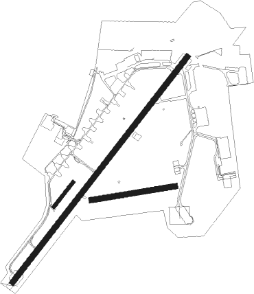
Runway info
Runway 04 / 22  | ||
| length | 2283m (7490ft) | |
| bearing | 54° / 234° | |
| width | 45m (148ft) | |
| surface | asphalt | |
| Runway 04L / 22R | ||
| length | 248m (814ft) | |
| bearing | 54° / 234° | |
| width | 30m (98ft) | |
| surface | grass | |
| Runway 08 / 26 | ||
| length | 676m (2218ft) | |
| bearing | 87° / 267° | |
| width | 45m (148ft) | |
| surface | grass | |
| displ threshold | 76m (249ft) / 0m (0ft) | |
Nearby beacons
| code | identifier | dist | bearing | frequency |
|---|---|---|---|---|
| OBI | OBERPFAFFENHOFEN NDB | 0.1 | 107° | 429 |
| MAH | MAISACH VOR/DME | 10.9 | 9° | 115.20 |
| LCH | LECHFELD TACAN | 18.2 | 284° | 108.80 |
| MSE | MUNICH NDB | 21.1 | 56° | 358 |
| OTT | OTTERSBERG VOR/DME | 22.1 | 79° | 112.30 |
| MNE | MUNICH NDB | 22.7 | 55° | 369 |
| AUG | DME | 24.8 | 315° | 115.90 |
| AGB | AUGSBURG NDB | 24.9 | 314° | 318 |
| DMS | DME | 25.2 | 62° | 115 |
| DMN | DME | 26.6 | 61° | 116 |
| MSW | MUNICH NDB | 29.6 | 66° | 400 |
| WLD | WALDA VOR/DME | 30.5 | 343° | 112.80 |
| MNW | MUNICH NDB | 30.7 | 65° | 338 |
| MIQ | MIKE NDB | 31.9 | 33° | 426 |
| NEU | NEUBURG TACAN | 38 | 353° | 108.90 |
| IGL | INGOLSTADT TACAN | 39.9 | 24° | 111.40 |
| IGL | INGOLSTADT NDB | 41.9 | 29° | 345 |
| KPT | KEMPTEN VOR/DME | 42.6 | 250° | 108.40 |
| RTT | RATTENBERG NDB | 47.2 | 135° | 303 |
| RUM | RUM NDB | 48.9 | 167° | 320 |
| INN | INNSBRUCK NDB | 51.3 | 172° | 420 |
| PAT | DME | 52.9 | 169° | 112 |
Departure and arrival routes
| Transition altitude | 5000ft |
| SID end points | distance | outbound heading | |
|---|---|---|---|
| RW22 | |||
| MAH2R, MAH7C | 11mi | 9° | |
| ATMA2R | 23mi | 254° | |
| STAR starting points | distance | inbound heading | |
|---|---|---|---|
| RW22 | |||
| NINU1B | 20.7 | 5° | |
| DISU4A | 14.9 | 39° | |
| MERS4A | 11.3 | 68° | |
Instrument approach procedures
| runway | airway (heading) | route (dist, bearing) |
|---|---|---|
| RW22 | MAH (189°) | MAH 5000ft MO220 (3mi, 82°) MO221 (5mi, 122°) 5000ft |
| RW22 | OBIKA (263°) | OBIKA 5000ft MO222 (3mi, 39°) MO221 (6mi, 302°) 5000ft |
| RNAV | MO221 5000ft EDIMO (4mi, 234°) 4000ft EDMO (7mi, 234°) 1959ft MO223 (2mi, 234°) MO224 (5mi, 100°) 3000ft MAH (14mi, 342°) 5000ft |
Holding patterns
| STAR name | hold at | type | turn | heading* | altitude | leg | speed limit |
|---|---|---|---|---|---|---|---|
| DISU4A | MAH | NDB | right | 311 (131)° | > 5000ft | 1.0min timed | ICAO rules |
| MERS4A | MAH | NDB | right | 311 (131)° | > 5000ft | 1.0min timed | ICAO rules |
| NINU1B | OBIKA | VHF | right | 246 (66)° | > 5000ft | 1.0min timed | ICAO rules |
| *) magnetic outbound (inbound) holding course | |||||||
Disclaimer
The information on this website is not for real aviation. Use this data with the X-Plane flight simulator only! Data taken with kind consent from X-Plane 12 source code and data files. Content is subject to change without notice.