Mühldorf Am Inn - Muehldorf
Airport details
| Country | Germany |
| State | Bavaria |
| Region | ED |
| Airspace | Munich Ctr |
| Municipality | Mühldorf a. Inn |
| Elevation | 1331ft (406m) |
| Timezone | GMT +1 |
| Coordinates | 48.27900, 12.50467 |
| Magnetic var | |
| Type | land |
| Available since | X-Plane v10.40 |
| ICAO code | EDMY |
| IATA code | n/a |
| FAA code | n/a |
Communication
| Muehldorf Muehldorf Info | 119.780 |
Nearby Points of Interest:
Innere Neumarkter Straße 1
-Wohn- und Geschäftshaus
-Bräugasse 20
-Maria-Eich-Kapelle
-Pfarrkirche
-Rathaus (Tüßling)
-Pfarrhof (Winhöring)
-Burgstall Kraiburg
-Heilig Geist (Neuötting)
-Stielhaus
-Kriegerdenkmal (Altötting)
-Kapellplatz
-Rathaus Altötting
-Hotel zur Post
-Rathaus Neuötting
-Altötting panorama building
-Pfarrhaus
-Schloss Waldberg
-Burg Megling
-Schloss Gangkofen
-Schlosskapelle Wald an der Alz
-Pfleghaus Wald an der Alz
-St. Rupertus (Ruprechtsberg)
-St. Petrus und Paulus (Erlbach)
-Gars Abbey
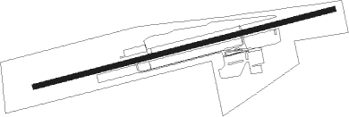
Runway info
| Runway 08 / 26 | ||
| length | 1220m (4003ft) | |
| bearing | 83° / 263° | |
| width | 20m (66ft) | |
| surface | asphalt | |
| displ threshold | 80m (262ft) / 420m (1378ft) | |
Nearby beacons
| code | identifier | dist | bearing | frequency |
|---|---|---|---|---|
| SBG | SALZBURG VOR/DME | 22.7 | 125° | 113.80 |
| MNW | MUNICH NDB | 24.2 | 279° | 338 |
| SBG | SALZBURG NDB | 24.3 | 129° | 382 |
| MSW | MUNICH NDB | 24.4 | 277° | 400 |
| OTT | OTTERSBERG VOR/DME | 28.1 | 262° | 112.30 |
| DMN | DME | 28.8 | 277° | 116 |
| DMS | DME | 29.2 | 275° | 115 |
| MNE | MUNICH NDB | 33.4 | 275° | 369 |
| SI | SALZBURG NDB | 33.7 | 134° | 410 |
| MSE | MUNICH NDB | 34.1 | 274° | 358 |
| GSB | DME | 37.4 | 128° | 109.45 |
| MIQ | MIKE NDB | 40.1 | 288° | 426 |
| IGL | INGOLSTADT NDB | 43.9 | 298° | 345 |
| IGL | INGOLSTADT TACAN | 45.6 | 295° | 111.40 |
| RDG | RODING VOR/DME | 45.7 | 2° | 114.70 |
| RTT | RATTENBERG NDB | 55.7 | 214° | 303 |
| HFX | HOHENFELS NDB | 61.9 | 326° | 286 |
Disclaimer
The information on this website is not for real aviation. Use this data with the X-Plane flight simulator only! Data taken with kind consent from X-Plane 12 source code and data files. Content is subject to change without notice.