Dinkelsbühl - Dinkelsbühl-sinbronn
Airport details
| Country | Germany |
| State | Bavaria |
| Region | ED |
| Airspace | Munich Ctr |
| Municipality | Dinkelsbühl |
| Elevation | 1598ft (487m) |
| Timezone | GMT +1 |
| Coordinates | 49.06595, 10.40160 |
| Magnetic var | |
| Type | land |
| Available since | X-Plane v10.32 |
| ICAO code | EDND |
| IATA code | n/a |
| FAA code | n/a |
Communication
| Dinkelsbühl-Sinbronn Dinkelsbuehl Info | 134.530 |
Nearby Points of Interest:
Pfarrhaus (Halsbach)
-Bischof-Rabeno-Platz 3
-Pfarrhaus (Wilburgstetten)
-Pfarrhaus (Weiltingen)
-Amtsgericht
-Stadtmühle Dinkelsbühl
-Altes Rathaus Dinkelsbühl
-Karmelitenkloster Dinkelsbühl
-Spitalkirche
-Deutsches Haus (Dinkelsbühl)
-Castra of Ruffenhofen
-Steinkreuz östlich von Burk
-Steinkreuz südlich von Burk
-Pfarrhaus
-Zum Taubenbrünnlein 2
-Ringstraße 86
-Zum Taubenbrünnlein 11
-Pfarrhaus (Hochaltingen)
-rectory
-Town hall in Wassertrüdingen
-Schloss Dennenlohe
-St. Georg (Sachsbach)
-Church of Kloster Maihingen
-Church in Großlellenfeld
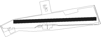
Runway info
| Runway 09 / 27 | ||
| length | 701m (2300ft) | |
| bearing | 92° / 272° | |
| width | 30m (98ft) | |
| surface | grass | |
Nearby beacons
| code | identifier | dist | bearing | frequency |
|---|---|---|---|---|
| DKB | DINKELSBUEHL VORTAC | 7.9 | 295° | 117.80 |
| ANS | ANSBACH NDB | 17.1 | 43° | 452 |
| ILM | ILLESHEIM NDB | 24.3 | 358° | 488 |
| SHD | HALL DME | 24.7 | 275° | 108.05 |
| NDD | DME-ILS | 26.1 | 307° | 108.70 |
| NSN | NIEDERSTETTEN NDB | 26.1 | 307° | 311 |
| NUB | NUERNBERG VOR/DME | 36.1 | 55° | 115.75 |
| NGD | DME | 37.2 | 57° | 113.10 |
| NEU | NEUBURG TACAN | 38.3 | 114° | 108.90 |
| WLD | WALDA VOR/DME | 41 | 124° | 112.80 |
| RTB | ROETHENBACH NDB | 41.7 | 64° | 415 |
| AGB | AUGSBURG NDB | 43.9 | 140° | 318 |
| AUG | DME | 43.9 | 140° | 115.90 |
| ERL | ERLANGEN VOR/DME | 45.9 | 52° | 114.90 |
| LUP | LAUPHEIM NDB | 54.5 | 210° | 407 |
| LCH | LECHFELD TACAN | 55.6 | 152° | 108.80 |
| MAH | MAISACH VOR/DME | 60.2 | 131° | 115.20 |
| OBI | OBERPFAFFENHOFEN NDB | 68.8 | 138° | 429 |
Disclaimer
The information on this website is not for real aviation. Use this data with the X-Plane flight simulator only! Data taken with kind consent from X-Plane 12 source code and data files. Content is subject to change without notice.