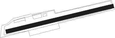
Bad Wörishofen - Bad Wörishofen-nord
Airport details
| Country | Germany |
| State | Bavaria |
| Region | ED |
| Airspace | Munich Ctr |
| Municipality | Bad Wörishofen |
| Elevation | 2029ft (618m) |
| Timezone | GMT +1 |
| Coordinates | 48.01633, 10.61600 |
| Magnetic var | |
| Type | land |
| Available since | X-Plane v10.32 |
| ICAO code | EDNH |
| IATA code | n/a |
| FAA code | n/a |
Communication
| Bad Wörishofen-Nord Bad Woerishofen Info | 122.600 |
Nearby Points of Interest:
Badehäuschen
-Pfarrhaus
-Altes Badehaus
-Alte Wandelhalle
-Kerkerkapelle
-Bildstock
-St. Peter und Paul
-Ehemals Pfarrhaus
-Hl. Kümmernis
-Mindelau Cemetery Chapel
-St. Magnus
-Mühle
-Lourdes chapel
-St. Maria (Helchenried)
-Geißelheiland (Amberg)
-Schloss Rio
-Rectory (Dirlewang)
-Bildstock in Apfeltrach
-St. Bartholomäus
Nearby beacons
| code | identifier | dist | bearing | frequency |
|---|---|---|---|---|
| ALG | ALLGAEU (MEMMINGEN) NDB | 14.2 | 267° | 341 |
| LCH | LECHFELD TACAN | 14.2 | 54° | 108.80 |
| ALD | (MEMMINGEN/ALLGAU) DME | 15.5 | 266° | 117.20 |
| KPT | KEMPTEN VOR/DME | 19.4 | 225° | 108.40 |
| OBI | OBERPFAFFENHOFEN NDB | 27.1 | 85° | 429 |
| AGB | AUGSBURG NDB | 27.5 | 38° | 318 |
| AUG | DME | 27.7 | 38° | 115.90 |
| LUP | LAUPHEIM NDB | 30.7 | 286° | 407 |
| MAH | MAISACH VOR/DME | 31.5 | 70° | 115.20 |
| WLD | WALDA VOR/DME | 39.5 | 42° | 112.80 |
| NEU | NEUBURG TACAN | 48 | 41° | 108.90 |
| MIQ | MIKE NDB | 51.4 | 61° | 426 |
| RUM | RUM NDB | 56.1 | 131° | 320 |
| IGL | INGOLSTADT TACAN | 56.7 | 54° | 111.40 |
| INN | INNSBRUCK NDB | 56.9 | 135° | 420 |
| PAT | DME | 59.3 | 134° | 112 |
Disclaimer
The information on this website is not for real aviation. Use this data with the X-Plane flight simulator only! Data taken with kind consent from X-Plane 12 source code and data files. Content is subject to change without notice.