Neuburg An Der Donau - Neuburg-egweil
Airport details
| Country | Germany |
| State | Bavaria |
| Region | ED |
| Airspace | Munich Ctr |
| Municipality | Egweil |
| Elevation | 1345ft (410m) |
| Timezone | GMT +1 |
| Coordinates | 48.78222, 11.21528 |
| Magnetic var | |
| Type | land |
| Available since | X-Plane v10.40 |
| ICAO code | EDNJ |
| IATA code | n/a |
| FAA code | n/a |
Communication
| Neuburg-Egweil Egweil Info | 123.475 |
Nearby Points of Interest:
St. Mauritius
-Villa Rustica
-Mariä Geburt
-Rathaus (Neuburg an der Donau)
-Staatliche Bibliothek Neuburg an der Donau
-Weveldhaus (Neuburg an der Donau)
-Evangelisch-reformierte Kirche (Marienheim)
-Burg Hütting
-Schloßberg in Wellheim mit Felsentor
-Figurenfeld Alois Wünsche-Mitterecker
-Burg Konstein
-Priesterseminar
-Ulmer Hof (Eichstätt)
-Residenz Eichstätt
-Luitpoldstraße 1
-Domplatz 3
-Pfahlstraße 27
-Marktplatz 15
-Kloster Marienstein
-Ruine Wielandstein (Wellheim)
-Friedhofskapelle
-Burg Dollnstein
-Volksschule Auf der Schanz
-Deutsches Medizinhistorisches Museum
-Tillyhaus
Runway info
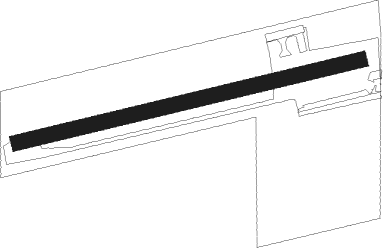
| Runway 08 / 26 | ||
| length | 669m (2195ft) | |
| bearing | 84° / 264° | |
| width | 30m (98ft) | |
| surface | grass | |
| displ threshold | 0m (0ft) / 82m (269ft) | |
Nearby beacons
| code | identifier | dist | bearing | frequency |
|---|---|---|---|---|
| NEU | NEUBURG TACAN | 4.1 | 184° | 108.90 |
| WLD | WALDA VOR/DME | 12.6 | 203° | 112.80 |
| IGL | INGOLSTADT TACAN | 14.5 | 100° | 111.40 |
| IGL | INGOLSTADT NDB | 17.2 | 96° | 345 |
| MIQ | MIKE NDB | 19.7 | 119° | 426 |
| AUG | DME | 24.1 | 218° | 115.90 |
| AGB | AUGSBURG NDB | 24.2 | 218° | 318 |
| MAH | MAISACH VOR/DME | 31.3 | 169° | 115.20 |
| MNE | MUNICH NDB | 31.5 | 133° | 369 |
| MSE | MUNICH NDB | 32 | 136° | 358 |
| DMN | DME | 33.9 | 126° | 116 |
| DMS | DME | 34.6 | 128° | 115 |
| HFX | HOHENFELS NDB | 36.4 | 56° | 286 |
| MNW | MUNICH NDB | 37 | 120° | 338 |
| MSW | MUNICH NDB | 37.6 | 122° | 400 |
| LCH | LECHFELD TACAN | 38.2 | 211° | 108.80 |
| ANS | ANSBACH NDB | 39 | 312° | 452 |
| RTB | ROETHENBACH NDB | 42 | 3° | 415 |
| OBI | OBERPFAFFENHOFEN NDB | 42.2 | 174° | 429 |
| OTT | OTTERSBERG VOR/DME | 43.3 | 135° | 112.30 |
| NGD | DME | 43.5 | 349° | 113.10 |
| NUB | NUERNBERG VOR/DME | 43.8 | 346° | 115.75 |
| DKB | DINKELSBUEHL VORTAC | 44.1 | 290° | 117.80 |
| ERL | ERLANGEN VOR/DME | 52.5 | 356° | 114.90 |
| ILM | ILLESHEIM NDB | 52.6 | 310° | 488 |
| ALG | ALLGAEU (MEMMINGEN) NDB | 60.5 | 231° | 341 |
| GRF | GRAFENWOHR TACAN | 61.5 | 38° | 111.80 |
| ALD | (MEMMINGEN/ALLGAU) DME | 61.7 | 231° | 117.20 |
| GRW | GRAFENWOHR NDB | 61.7 | 39° | 405 |
Disclaimer
The information on this website is not for real aviation. Use this data with the X-Plane flight simulator only! Data taken with kind consent from X-Plane 12 source code and data files. Content is subject to change without notice.