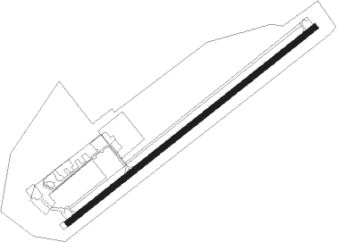
Airports for X-Plane offers a convenient way to explore airports and their related communication information for the X-Plane flight simulator. It only uses data from the X-Plane flight simulator itself, and is therefore more reliable than the data that comes from real aviation websites. You can search for airports by using the ICAO code, or browse for airports per country and state. The information displayed is categorized by airport details, runway information, airport communication, approach frequencies (ILS and Glidepath details), details of nearby beacons, SIDs, STARs and approach procedures.

newark airport check-in heliport taxi hangar public transport airliner rail hospital railway station aerodrome hotel runway embassy aviation field airborne gravel arrival international

Leutkirch - Leutkirch - Unterzeil

Airport details

CountryGermany
StateBaden-Württemberg
RegionED
AirspaceMunich Ctr
MunicipalityLeutkirch im Allgäu
Elevation2099ft (640m)
TimezoneGMT +1
Coordinates47.85883, 10.01433
Magnetic var
Typeland
Available sinceX-Plane v10.40
ICAO codeEDNL
IATA coden/a
FAA coden/a

Communication

Leutkirch - Unterzeil Leutkirch Info122.875
Nearby Points of Interest:
Franziskanerinnenkloster Leutkirch im Allgäu
-
Dorfkapelle Starkenhofen
-
St. Maria
-
Schloss Lautrach
-
Fatimakapelle (Aitrach)
-
Wegkapelle zur Schmerzhaften Muttergottes
-
St. Johannes von Nepomuk
-
St. Sebastian (Greuth)
-
Bildstock (Kronburg)
-
Zehntstadel Kronburg
-
Bildstock
-
Pestkapelle (Kimratshofen)
-
St. Petrus in Ketten
-
Saint Michael Chapel (Diesenbach, Altusried)
-
Burgstall Im Buschel
-
St. Magnus (Sommersberg)
-
Fliehburg (Woringen)
-
Kollegiatstift Bad Grönenbach
-
Saint Magnus of Füssen Chapel
-
City Hall (Bad Grönenbach)
-
Untere Burg
-
Zehntstadel
-
St. Anna
-
Dinkelmühle Graf
-
Bauernhaus „St. Medardus“

Runway info

Runway 06 / 24
 length1018m (3340ft)
 bearing66° / 246°
 width20m (66ft)
 surfaceasphalt
 displ threshold180m (591ft) / 59m (194ft)

Airport layout


Parking locations

Nearby beacons

codeidentifierdistbearingfrequency
ALD(MEMMINGEN/ALLGAU) DME11.759°117.20
ALGALLGAEU (MEMMINGEN) NDB12.961°341
KPTKEMPTEN VOR/DME15.1109°108.40
LUPLAUPHEIM NDB21.9344°407
FHDDME23.5249°112.60
LCHLECHFELD TACAN39.369°108.80
AGBAUGSBURG NDB5058°318
AUGDME50.258°115.90
TGOTANGO TACAN54.7315°112.50
STGSTUTTGART VOR/DME58.7318°116.85
SGDDME58.9316°115.45

Disclaimer

The information on this website is not for real aviation. Use this data with the X-Plane flight simulator only! Data taken with kind consent from X-Plane 12 source code and data files. Content is subject to change without notice.