Schwabmünchen - Schwabmuenchen
Airport details
| Country | Germany |
| State | Bavaria |
| Region | ED |
| Airspace | Munich Ctr |
| Municipality | Schwabmünchen |
| Elevation | 1804ft (550m) |
| Timezone | GMT +1 |
| Coordinates | 48.17933, 10.70283 |
| Magnetic var | |
| Type | land |
| Available since | X-Plane v10.45 |
| ICAO code | EDNS |
| IATA code | n/a |
| FAA code | n/a |
Communication
| Schwabmuenchen Schwabmuenchen Info | 122.500 |
Nearby Points of Interest:
Pfarrhof
-Baindl-Kapelle
-St. Maria (Ellenried)
-St. Nikolaus (Siegertshofen)
-Schloss
-Kloster Lechfeld
-Feldkapelle
-Schloss Lamerdingen
-Pfarrhaus
-Pfarrhaus (Immelstetten)
-Rectory (Kleinaitingen)
-rectory
-St. Michael (Fischach)
-Geißelheiland (Amberg)
-Burgstall im Viehtrieb (Straßberg)
-Mühle
-Pfarrhaus (Eppishausen)
-Pfarrhaus ehem.
-Kalvarienberg
-Saint George Church
-St. Antonius
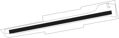
Runway info
| Runway 08 / 26 | ||
| length | 847m (2779ft) | |
| bearing | 86° / 266° | |
| width | 29m (95ft) | |
| surface | grass | |
Nearby beacons
| code | identifier | dist | bearing | frequency |
|---|---|---|---|---|
| LCH | LECHFELD TACAN | 6.2 | 86° | 108.80 |
| AGB | AUGSBURG NDB | 17.3 | 43° | 318 |
| AUG | DME | 17.4 | 44° | 115.90 |
| ALG | ALLGAEU (MEMMINGEN) NDB | 20.7 | 248° | 341 |
| ALD | (MEMMINGEN/ALLGAU) DME | 22.1 | 248° | 117.20 |
| OBI | OBERPFAFFENHOFEN NDB | 24 | 100° | 429 |
| MAH | MAISACH VOR/DME | 24.8 | 82° | 115.20 |
| WLD | WALDA VOR/DME | 29.4 | 47° | 112.80 |
| KPT | KEMPTEN VOR/DME | 29.6 | 219° | 108.40 |
| LUP | LAUPHEIM NDB | 31.7 | 273° | 407 |
| NEU | NEUBURG TACAN | 37.8 | 44° | 108.90 |
| MSE | MUNICH NDB | 39 | 81° | 358 |
| MNE | MUNICH NDB | 40.3 | 80° | 369 |
| MIQ | MIKE NDB | 42.7 | 66° | 426 |
| IGL | INGOLSTADT TACAN | 47.3 | 58° | 111.40 |
| IGL | INGOLSTADT NDB | 50.3 | 59° | 345 |
| DKB | DINKELSBUEHL VORTAC | 60.7 | 334° | 117.80 |
| RUM | RUM NDB | 62.3 | 140° | 320 |
| INN | INNSBRUCK NDB | 63.6 | 144° | 420 |
| PAT | DME | 65.8 | 142° | 112 |
| SHD | HALL DME | 67.1 | 315° | 108.05 |
Disclaimer
The information on this website is not for real aviation. Use this data with the X-Plane flight simulator only! Data taken with kind consent from X-Plane 12 source code and data files. Content is subject to change without notice.