Thannhausen
Airport details
| Country | Germany |
| State | Bavaria |
| Region | ED |
| Airspace | Munich Ctr |
| Municipality | Thannhausen |
| Elevation | 1609ft (490m) |
| Timezone | GMT +1 |
| Coordinates | 48.29028, 10.44194 |
| Magnetic var | |
| Type | land |
| Available since | X-Plane v10.40 |
| ICAO code | EDNU |
| IATA code | n/a |
| FAA code | n/a |
Communication
| Thannhausen Thannhausen Info | 118.175 |
Nearby Points of Interest:
Rathaus
-Ölbergkapelle
-Pfarrhof
-Unseres Herren Ruh
-Ensemble Ortskern Burtenbach
-Pfarrhaus
-Heinrich-Sinz-Straße 5
-Doppelhaus
-Wohnhaus, sogenanntes Rixner-Haus
-Ehemals Judenhaus
-Saint George Church
-Kalvarienberg
-Rectory (Ettelried)
-St. Antonius
-Kriegergedächtniskapelle (Nattenhausen)
-Pfarrhaus ehem.
-rectory
-Pfarrhaus Breitenthal (Schwaben)
-Mariä Himmelfahrt (Dinkelscherben)
-Emblemata of Kloster Wettenhausen
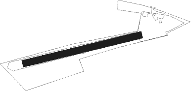
Runway info
| Runway 08 / 26 | ||
| length | 501m (1644ft) | |
| bearing | 84° / 264° | |
| width | 29m (95ft) | |
| surface | grass | |
Nearby beacons
| code | identifier | dist | bearing | frequency |
|---|---|---|---|---|
| LCH | LECHFELD TACAN | 17.7 | 103° | 108.80 |
| ALG | ALLGAEU (MEMMINGEN) NDB | 19 | 212° | 341 |
| ALD | (MEMMINGEN/ALLGAU) DME | 19.9 | 215° | 117.20 |
| AGB | AUGSBURG NDB | 21.1 | 75° | 318 |
| AUG | DME | 21.3 | 75° | 115.90 |
| LUP | LAUPHEIM NDB | 21.6 | 262° | 407 |
| WLD | WALDA VOR/DME | 32.4 | 67° | 112.80 |
| KPT | KEMPTEN VOR/DME | 32.9 | 190° | 108.40 |
| MAH | MAISACH VOR/DME | 34.8 | 92° | 115.20 |
| OBI | OBERPFAFFENHOFEN NDB | 36 | 104° | 429 |
| NEU | NEUBURG TACAN | 39.7 | 61° | 108.90 |
| DKB | DINKELSBUEHL VORTAC | 51.8 | 347° | 117.80 |
| FHD | DME | 53 | 236° | 112.60 |
| SHD | HALL DME | 56.1 | 321° | 108.05 |
Disclaimer
The information on this website is not for real aviation. Use this data with the X-Plane flight simulator only! Data taken with kind consent from X-Plane 12 source code and data files. Content is subject to change without notice.