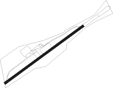
Vogtareuth
Airport details
| Country | Germany |
| State | Bavaria |
| Region | ED |
| Airspace | Munich Ctr |
| Municipality | Vogtareuth |
| Elevation | 1535ft (468m) |
| Timezone | GMT +1 |
| Coordinates | 47.94600, 12.20467 |
| Magnetic var | |
| Type | land |
| Available since | X-Plane v10.40 |
| ICAO code | EDNV |
| IATA code | n/a |
| FAA code | n/a |
Communication
| Vogtareuth Vograreuth Info | 121.025 |
Nearby Points of Interest:
Unsere Liebe Frau (Feldkirchen)
-Rathaus Schechen
-Rott Abbey
-St. Marinus und Anianus (Rott am Inn)
-Schloss Hart
-Römischer Grabaltar (Eiselfing)
-Burg Rosenheim
-Pfarrhaus
-Papierwarenfabrik Rosenheim
-Luitpold-Gymnasium Wasserburg am Inn
-Amtsgericht Wasserburg am Inn
-Schloss Penzing
-Schloss Eichbichl
-Wohnteil des Einfirsthofes
-Chiemsee-Bahn
-Schloss Brandstätt
-Rathaus Aßling
-St. Laurentius
-Augustinerchorherrenstift Beyharting
-Wallfahrtskirche Heilig Kreuz
-Amtsgericht Bad Aibling
-Getreidekasten
-Toteisloch bei Klosterseeon
-Pfarrhof
-Seeon Abbey
Nearby beacons
| code | identifier | dist | bearing | frequency |
|---|---|---|---|---|
| OTT | OTTERSBERG VOR/DME | 20.9 | 301° | 112.30 |
| MSW | MUNICH NDB | 27.2 | 323° | 400 |
| SBG | SALZBURG NDB | 27.7 | 88° | 382 |
| SBG | SALZBURG VOR/DME | 27.8 | 85° | 113.80 |
| MNW | MUNICH NDB | 28.2 | 326° | 338 |
| DMS | DME | 29.2 | 313° | 115 |
| DMN | DME | 30.1 | 316° | 116 |
| MSE | MUNICH NDB | 32 | 305° | 358 |
| MNE | MUNICH NDB | 32.4 | 308° | 369 |
| SI | SALZBURG NDB | 32.4 | 99° | 410 |
| RTT | RATTENBERG NDB | 32.7 | 207° | 303 |
| GSB | DME | 37.5 | 99° | 109.45 |
| OBI | OBERPFAFFENHOFEN NDB | 37.8 | 278° | 429 |
| MAH | MAISACH VOR/DME | 40.5 | 290° | 115.20 |
| MIQ | MIKE NDB | 44.6 | 316° | 426 |
| RUM | RUM NDB | 50.1 | 228° | 320 |
| IGL | INGOLSTADT NDB | 52.5 | 325° | 345 |
| IGL | INGOLSTADT TACAN | 52.8 | 321° | 111.40 |
| PAT | DME | 53.5 | 225° | 112 |
| INN | INNSBRUCK NDB | 53.9 | 228° | 420 |
| NEU | NEUBURG TACAN | 60.7 | 308° | 108.90 |
Disclaimer
The information on this website is not for real aviation. Use this data with the X-Plane flight simulator only! Data taken with kind consent from X-Plane 12 source code and data files. Content is subject to change without notice.