Weißenhorn - Weissenhorn
Airport details
| Country | Germany |
| State | Bavaria |
| Region | ED |
| Airspace | Munich Ctr |
| Municipality | Weißenhorn |
| Elevation | 1643ft (501m) |
| Timezone | GMT +1 |
| Coordinates | 48.28944, 10.14028 |
| Magnetic var | |
| Type | land |
| Available since | X-Plane v10.40 |
| ICAO code | EDNW |
| IATA code | n/a |
| FAA code | n/a |
Communication
| Weissenhorn Weissenhorn Info | 119.425 |
Nearby Points of Interest:
rectory
-Burgus Finningen
-Schloss Autenried
-Rectory (Autenried)
-Feldkapelle Silheim
-Postweg 1
-Pfarrhaus Breitenthal (Schwaben)
-Altes Rathaus
-Pfarrhaus
-Mariä Geburt
-Kriegergedächtniskapelle (Nattenhausen)
-Postamt
-Rathaus
-Ensemble Marktstraße/Heinrich-Sinz-Straße
-Rectory (Pfuhl)
-Roßkammhaus
-Marktstraße 21
-St. Petrus von Alcantara
-Evangelisch-lutherische Pfarrkirche (Ichenhausen)
-Reichenauer Hof
-Ulmer Münz
-Pfarrkirche St. Michael
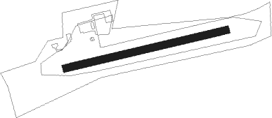
Runway info
| Runway 08 / 26 | ||
| length | 648m (2126ft) | |
| bearing | 84° / 264° | |
| width | 29m (95ft) | |
| surface | grass | |
Nearby beacons
| code | identifier | dist | bearing | frequency |
|---|---|---|---|---|
| LUP | LAUPHEIM NDB | 10.1 | 253° | 407 |
| ALG | ALLGAEU (MEMMINGEN) NDB | 18.2 | 157° | 341 |
| ALD | (MEMMINGEN/ALLGAU) DME | 18.4 | 163° | 117.20 |
| LCH | LECHFELD TACAN | 29.3 | 98° | 108.80 |
| AGB | AUGSBURG NDB | 32.6 | 80° | 318 |
| AUG | DME | 32.8 | 80° | 115.90 |
| KPT | KEMPTEN VOR/DME | 33.7 | 159° | 108.40 |
| TGO | TANGO TACAN | 40.2 | 290° | 112.50 |
| STG | STUTTGART VOR/DME | 42.8 | 295° | 116.85 |
| WLD | WALDA VOR/DME | 43 | 74° | 112.80 |
| SGD | DME | 43.6 | 294° | 115.45 |
| FHD | DME | 45.2 | 226° | 112.60 |
| LBU | LUBURG VOR/DME | 49.1 | 308° | 109.20 |
| DKB | DINKELSBUEHL VORTAC | 51.3 | 7° | 117.80 |
| SHD | HALL DME | 51.7 | 336° | 108.05 |
Disclaimer
The information on this website is not for real aviation. Use this data with the X-Plane flight simulator only! Data taken with kind consent from X-Plane 12 source code and data files. Content is subject to change without notice.