Oberschleißheim - Oberschleissheim
Airport details
| Country | Germany |
| State | Bavaria |
| Region | ED |
| Airspace | Munich Ctr |
| Municipality | Oberschleißheim |
| Elevation | 1596ft (486m) |
| Timezone | GMT +1 |
| Coordinates | 48.23900, 11.55917 |
| Magnetic var | |
| Type | land |
| Available since | X-Plane v10.40 |
| ICAO code | EDNX |
| IATA code | n/a |
| FAA code | n/a |
Communication
| Oberschleissheim Schleissheim Info | 131.130 |
Nearby Points of Interest:
Schleißheim airfield
-Pumpwerk
-Künstlerhaus
-Rathaus
-Ehemaliger Jagdpavillon
-Künstlervilla
-Wasserturm Hochbrück
-BMW Group Classic
-St. Georg (Milbertshofen)
-Gut Großlappen
-Hochhaus Riesstraße 82
-Olympia Tower
-Funkkaserne
-Gasthaus Spiegl
-BMW Headquarters
-Pfarrhaus (Moosach)
-Olympiahalle
-Max Planck Institute for Physics
-Max Planck Institute of Psychiatry
-Olympic Roof Munich
-Wasserturm
-Gasthaus
-Heilig Kreuz (Schwabing-West)
-Klinikum Schwabing
-Pfarrhaus
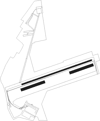
Runway info
Runway 07 / 25  | ||
| length | 809m (2654ft) | |
| bearing | 80° / 260° | |
| width | 16m (51ft) | |
| surface | asphalt | |
| Runway 07R / 25L | ||
| length | 250m (820ft) | |
| bearing | 80° / 260° | |
| width | 30m (98ft) | |
| surface | grass | |
| Runway 09R / 27L | ||
| length | 250m (820ft) | |
| bearing | 80° / 260° | |
| width | 30m (98ft) | |
| surface | grass | |
Nearby beacons
| code | identifier | dist | bearing | frequency |
|---|---|---|---|---|
| MSE | MUNICH NDB | 6.7 | 45° | 358 |
| MNE | MUNICH NDB | 8.4 | 45° | 369 |
| MAH | MAISACH VOR/DME | 9.9 | 276° | 115.20 |
| DMS | DME | 10.6 | 65° | 115 |
| OTT | OTTERSBERG VOR/DME | 10.8 | 103° | 112.30 |
| DMN | DME | 12.1 | 61° | 116 |
| OBI | OBERPFAFFENHOFEN NDB | 14.5 | 240° | 429 |
| MSW | MUNICH NDB | 15.3 | 72° | 400 |
| MNW | MUNICH NDB | 16.3 | 69° | 338 |
| MIQ | MIKE NDB | 19.9 | 7° | 426 |
| WLD | WALDA VOR/DME | 26.6 | 308° | 112.80 |
| AUG | DME | 27.2 | 287° | 115.90 |
| AGB | AUGSBURG NDB | 27.3 | 286° | 318 |
| LCH | LECHFELD TACAN | 28.1 | 266° | 108.80 |
| IGL | INGOLSTADT TACAN | 28.7 | 1° | 111.40 |
| IGL | INGOLSTADT NDB | 30.1 | 10° | 345 |
| NEU | NEUBURG TACAN | 31.6 | 324° | 108.90 |
| RTT | RATTENBERG NDB | 50.9 | 155° | 303 |
| RUM | RUM NDB | 57.9 | 186° | 320 |
| HFX | HOHENFELS NDB | 60 | 17° | 286 |
| RDG | RODING VOR/DME | 61.5 | 50° | 114.70 |
Disclaimer
The information on this website is not for real aviation. Use this data with the X-Plane flight simulator only! Data taken with kind consent from X-Plane 12 source code and data files. Content is subject to change without notice.