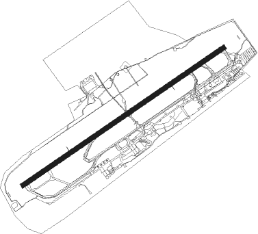
Friedrichshafen
Airport details
| Country | Germany |
| State | Baden-Württemberg |
| Region | ED |
| Airspace | Munich Ctr |
| Municipality | Friedrichshafen |
| Elevation | 1367ft (417m) |
| Timezone | GMT +1 |
| Coordinates | 47.67132, 9.51149 |
| Magnetic var | |
| Type | land |
| Available since | X-Plane v10.40 |
| ICAO code | EDNY |
| IATA code | FDH |
| FAA code | n/a |
Communication
| Friedrichshafen Friedrichshafen ATIS | 129.605 |
| Friedrichshafen Friedrichshafen Tower | 120.080 |
| Friedrichshafen Tower | 134.305 |
| Friedrichshafen ZURICH INFO | 124.700 |
Approach frequencies
| ILS-cat-III | RW24 | 111.9 | 18.00mi |
| ILS-cat-I | RW06 | 111.9 | 18.00mi |
| 3.1° GS | RW06 | 111.9 | 18.00mi |
| 3° GS | RW24 | 111.9 | 18.00mi |
Nearby Points of Interest:
Georgskapelle (Tettnang)
-Torschloss (Tettnang)
-Kulturhaus Mühle
-Schloss Liebenau
-Schwörer-Haus
-Landgericht Ravensburg
-rectory
-Altes Theater
-Pfarrkirche St. Jodok
-Amtsgericht Ravensburg
-Bauten der ehemaligen eidgenössischen Alkoholverwaltung
-Kesswil
-Arbon
-Luitpold-Kaserne in Lindau
-Lindavia-Brunnen
-Heilig-Geist-Spital
-Feuchtmayer Museum
-Blasiuskapelle in Briach
-Altnau
-Speidlerhaus
-Sommeri
-Roggwil
-Rorschach
-Warteggpark
Nearby beacons
| code | identifier | dist | bearing | frequency |
|---|---|---|---|---|
| FHD | DME | 0.3 | 239° | 112.60 |
| ZUE | ZURICH EAST VOR/DME | 28.4 | 263° | 110.05 |
| KPT | KEMPTEN VOR/DME | 34.1 | 85° | 108.40 |
| ALD | (MEMMINGEN/ALLGAU) DME | 34.7 | 66° | 117.20 |
| ALG | ALLGAEU (MEMMINGEN) NDB | 36 | 67° | 341 |
| LUP | LAUPHEIM NDB | 36.5 | 36° | 407 |
| KLO | KLOTEN (ZURICH) VOR/DME | 41.2 | 257° | 114.85 |
| WFJ | DME | 51.5 | 161° | 113.75 |
| SUL | SULZ VOR | 55 | 309° | 116.10 |
| TGO | TANGO TACAN | 57.7 | 345° | 112.50 |
Departure and arrival routes
| Transition altitude | 5000ft |
| SID end points | distance | outbound heading | |
|---|---|---|---|
| RW06 | |||
| KPT5E | 34mi | 85° | |
| BEMK3E | 33mi | 98° | |
| SITO2E | 12mi | 227° | |
| AMIK3E | 20mi | 258° | |
| TRA3E | 43mi | 271° | |
| RW24 | |||
| KPT5W | 34mi | 85° | |
| BEMK3W | 33mi | 98° | |
| SITO2W | 12mi | 227° | |
| AMIK3W | 20mi | 258° | |
| TRA3W | 43mi | 271° | |
| STAR starting points | distance | inbound heading | |
|---|---|---|---|
| ALL | |||
| ROLS4P | 34.1 | 58° | |
| ZUE5P | 28.4 | 83° | |
| GARM2P | 11.2 | 120° | |
| KPT7P | 34.1 | 265° | |
| RW06 | |||
| ROLS06 | 34.1 | 58° | |
| ZUE06 | 28.4 | 83° | |
| GARM06 | 11.2 | 120° | |
| KPT06 | 34.1 | 265° | |
| RW24 | |||
| ROLS24 | 34.1 | 58° | |
| ZUE24 | 28.4 | 83° | |
| GARM24 | 11.2 | 120° | |
| KPT24 | 34.1 | 265° | |
Instrument approach procedures
| runway | airway (heading) | route (dist, bearing) |
|---|---|---|
| RW06 | MOKOP (115°) | MOKOP 5000ft NY420 (10mi, 249°) 5000ft RUDSI (5mi, 139°) 4000ft ARGEV (4mi, 69°) 4000ft |
| RNAV | ARGEV 4000ft EDNY (8mi, 69°) 1385ft NY480 (2mi, 69°) (2907mi, 191°) 2000ft NY481 (2911mi, 11°) MOKOP (5mi, 257°) 5000ft | |
| RW24 | MOKOP (115°) | MOKOP 5000ft NY444 (16mi, 100°) 5000ft NY445 (5mi, 69°) 5000ft NY435 (5mi, 320°) 4000ft ETREM (5mi, 249°) 4000ft |
| RNAV | ETREM 4000ft EDNY (9mi, 249°) 1418ft NY490 (5mi, 249°) (2902mi, 191°) 3000ft NY491 (2907mi, 11°) MOKOP (2mi, 77°) 5000ft |
Holding patterns
| STAR name | hold at | type | turn | heading* | altitude | leg | speed limit |
|---|---|---|---|---|---|---|---|
| GARM2P | MOKOP | VHF | right | 68 (248)° | > 5000ft | 1.0min timed | ICAO rules |
| KPT7P | MOKOP | VHF | right | 68 (248)° | > 5000ft | 1.0min timed | ICAO rules |
| ROLS4P | MOKOP | VHF | right | 68 (248)° | > 5000ft | 1.0min timed | ICAO rules |
| ZUE5P | MOKOP | VHF | right | 68 (248)° | > 5000ft | 1.0min timed | ICAO rules |
| *) magnetic outbound (inbound) holding course | |||||||
Disclaimer
The information on this website is not for real aviation. Use this data with the X-Plane flight simulator only! Data taken with kind consent from X-Plane 12 source code and data files. Content is subject to change without notice.