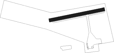
Gardelegen
Airport details
| Country | Germany |
| State | Saxony-Anhalt |
| Region | ED |
| Airspace | Bremen Ctr |
| Municipality | Gardelegen |
| Elevation | 229ft (70m) |
| Timezone | GMT +1 |
| Coordinates | 52.52778, 11.35417 |
| Magnetic var | |
| Type | land |
| Available since | X-Plane v10.40 |
| ICAO code | EDOC |
| IATA code | n/a |
| FAA code | n/a |
Communication
| Gardelegen Gardelegen Info | 122.850 |
Runway info
| Runway 08 / 26 | ||
| length | 588m (1929ft) | |
| bearing | 86° / 266° | |
| width | 40m (131ft) | |
| surface | grass | |
Nearby beacons
| code | identifier | dist | bearing | frequency |
|---|---|---|---|---|
| HLZ | HEHLINGEN VOR/DME | 22.7 | 254° | 117.30 |
| BRU | BRAUNSCHWEIG-WOLFSBURG NDB | 30 | 255° | 427 |
| BKD | BRUENKENDORF VOR/DME | 31.2 | 21° | 117.70 |
| MAG | MAGDEBURG VOR/DME | 35.8 | 140° | 110.45 |
| CB | COCHSTEDT NDB | 40.2 | 172° | 344 |
| PAH | SCHWERIN-PARCHIM NDB | 53.2 | 20° | 315 |
| PMD | DME | 56 | 26° | 117.50 |
| PI | SCHWERIN-PARCHIM NDB | 59.5 | 31° | 333 |
Disclaimer
The information on this website is not for real aviation. Use this data with the X-Plane flight simulator only! Data taken with kind consent from X-Plane 12 source code and data files. Content is subject to change without notice.
