Böhlen - Boehlen
Airport details
| Country | Germany |
| State | Saxony |
| Region | ED |
| Airspace | Munich Ctr |
| Municipality | Böhlen |
| Elevation | 430ft (131m) |
| Timezone | GMT +1 |
| Coordinates | 51.21528, 12.36778 |
| Magnetic var | |
| Type | land |
| Available since | X-Plane v10.40 |
| ICAO code | EDOE |
| IATA code | n/a |
| FAA code | n/a |
Communication
| Boehlen INFO | 123.000 |
Nearby Points of Interest:
Georgenkirche
-Dorfkirche Zitzschen
-Parkgaststätte Im Dölitzer Holz 20
-Ehemaliges Park-Krankenhaus Leipzig-Dösen
-Villa Schomburgk
-Hafis-Gedenkstein
-Handschwengelpumpen in Leipzig
-Connewitzer Kreuz
-Richard-Lehmann-Straße
-Schlachthof Leipzig
-Kolonialstein
-Messehalle 15 Prager Straße 200
-Großmarkthalle Leipzig
-Alte Handelsschule
-Deutsche Bücherei
-Villa Schwägrichenstraße 23
-Rotes Haus
-Wohnhaus Philipp-Rosenthal-Straße 21
-Monarchenhügel bei Großgörschen
-Liebfrauenkirche
-Bibliotheca Albertina
-Villa Gebhardt, Leipzig
-Villa Nauhardt
-Lincks Gartenhaus
-Villa Baedeker
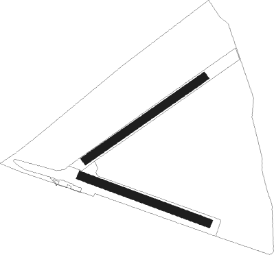
Runway info
Runway 06 / 24  | ||
| length | 701m (2300ft) | |
| bearing | 70° / 250° | |
| width | 40m (131ft) | |
| surface | grass | |
| Runway 11 / 29 | ||
| length | 655m (2149ft) | |
| bearing | 106° / 286° | |
| width | 40m (131ft) | |
| surface | grass | |
Nearby beacons
| code | identifier | dist | bearing | frequency |
|---|---|---|---|---|
| SKZ | SCHKEUDITZ (LEIPZIG-HALLE) NDB | 12.5 | 334° | 357 |
| LLD | SOUTH(LEIPZIG- DME | 13 | 325° | 112.15 |
| ZIG | LEIPZIG NDB | 13.5 | 338° | 340 |
| LEG | LEIPZIG VOR/DME | 13.8 | 26° | 115.85 |
| LND | NORTH(LEIPZIG- DME | 14.1 | 327° | 113.50 |
| ABU | ALTENBURG NDB | 14.5 | 145° | 330 |
| AGD | DME | 14.9 | 148° | 115.30 |
| GOT | GOTEM VOR/DME | 29.9 | 279° | 115.25 |
| HOZ | HOLZDORF NDB | 43 | 53° | 406 |
| HOZ | HOLZDORF TACAN | 45.4 | 56° | 117.25 |
| MAG | MAGDEBURG VOR/DME | 51.4 | 324° | 110.45 |
| CB | COCHSTEDT NDB | 51.7 | 305° | 344 |
Disclaimer
The information on this website is not for real aviation. Use this data with the X-Plane flight simulator only! Data taken with kind consent from X-Plane 12 source code and data files. Content is subject to change without notice.