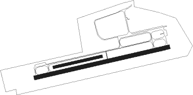
Stendal - Stendal-borstel
Airport details
| Country | Germany |
| State | Saxony-Anhalt |
| Region | ED |
| Airspace | Bremen Ctr |
| Municipality | Stendal |
| Elevation | 184ft (56m) |
| Timezone | GMT +1 |
| Coordinates | 52.63147, 11.83146 |
| Magnetic var | |
| Type | land |
| Available since | X-Plane v10.40 |
| ICAO code | EDOV |
| IATA code | ZSN |
| FAA code | n/a |
Communication
| Stendal-Borstel Stendal Info | 122.405 |
Nearby Points of Interest:
Protestant Church Borstel
-Dorfkirche Schernikau
-Röxer Tunnel
-Christuskirche (Stendal)
-Protestant Church Eichstedt (Altmark)
-Dorfkirche Tornau
-Kirche Groß Schwechten
-Tornauer Windmühle
-Protestant Church Bindfelde
-Dorfkirche Döbbelin
-Church in Möringen
-Dorfkirche Dahlen
-Protestant Church (Lindtorf)
-Steinfeld church
-Dorfkirche Gohre
-Protestant Church Staffelde
-Dorfkirche Insel
-Dorfkirche Dahrenstedt
-Dorfkirche Nahrstedt
-Church of Rochau
-Protestant Church Buchholz (Altmark)
-Church Welle
-Kriegerdenkmal Miltern
-Dorfkirche Heeren
-Dorfkirche Hämerten

Nearby beacons
| code | identifier | dist | bearing | frequency |
|---|---|---|---|---|
| BKD | BRUENKENDORF VOR/DME | 26.3 | 325° | 117.70 |
| MAG | MAGDEBURG VOR/DME | 38.2 | 183° | 110.45 |
| PAH | SCHWERIN-PARCHIM NDB | 46.1 | 348° | 315 |
| PMD | DME | 47.6 | 357° | 117.50 |
| CB | COCHSTEDT NDB | 48.3 | 206° | 344 |
| PI | SCHWERIN-PARCHIM NDB | 49.9 | 5° | 333 |
Disclaimer
The information on this website is not for real aviation. Use this data with the X-Plane flight simulator only! Data taken with kind consent from X-Plane 12 source code and data files. Content is subject to change without notice.