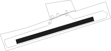
Dingolfing
Airport details
| Country | Germany |
| State | Bavaria |
| Region | ED |
| Airspace | Munich Ctr |
| Municipality | Dingolfing |
| Elevation | 1099ft (335m) |
| Timezone | GMT +1 |
| Coordinates | 48.65778, 12.50056 |
| Magnetic var | |
| Type | land |
| Available since | X-Plane v10.45 |
| ICAO code | EDPD |
| IATA code | n/a |
| FAA code | n/a |
Communication
| Dingolfing Dingolfing Info | 123.600 |
Nearby beacons
| code | identifier | dist | bearing | frequency |
|---|---|---|---|---|
| RDG | RODING VOR/DME | 22.9 | 4° | 114.70 |
| MNW | MUNICH NDB | 28.8 | 244° | 338 |
| MSW | MUNICH NDB | 30 | 243° | 400 |
| DMN | DME | 33 | 248° | 116 |
| IGL | INGOLSTADT NDB | 34.2 | 275° | 345 |
| DMS | DME | 34.4 | 246° | 115 |
| MIQ | MIKE NDB | 36.2 | 264° | 426 |
| IGL | INGOLSTADT TACAN | 37 | 274° | 111.40 |
| MNE | MUNICH NDB | 37.4 | 250° | 369 |
| MSE | MUNICH NDB | 38.9 | 249° | 358 |
| OTT | OTTERSBERG VOR/DME | 39.5 | 235° | 112.30 |
| HFX | HOHENFELS NDB | 42.1 | 311° | 286 |
| SBG | SALZBURG VOR/DME | 42.3 | 149° | 113.80 |
| SBG | SALZBURG NDB | 44.3 | 150° | 382 |
| SI | SALZBURG NDB | 54 | 150° | 410 |
| GSB | DME | 56.7 | 144° | 109.45 |
Disclaimer
The information on this website is not for real aviation. Use this data with the X-Plane flight simulator only! Data taken with kind consent from X-Plane 12 source code and data files. Content is subject to change without notice.
