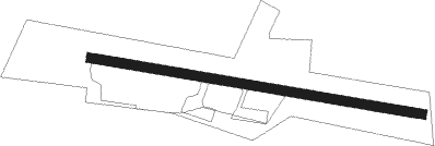
Schwabach - Schwabach-buechenbach
Airport details
| Country | Germany |
| State | Bavaria |
| Region | ED |
| Airspace | Munich Ctr |
| Municipality | Büchenbach |
| Elevation | 1181ft (360m) |
| Timezone | GMT +1 |
| Coordinates | 49.26867, 11.00950 |
| Magnetic var | |
| Type | land |
| Available since | X-Plane v10.40 |
| ICAO code | EDPH |
| IATA code | n/a |
| FAA code | n/a |
Communication
| Schwabach-Buechenbach Schwabach Info | 135.425 |
Nearby Points of Interest:
Burgstall Osterwiese
-Burgkapelle
-Rathaus Abenberg
-Stillaplatz 10 (Abenberg)
-Oberes Tor (Abenberg)
-Altes Rathaus in Roth
-Boxlohe 5
-Synagogengasse 6 (Schwabach)
-Kapelle (Kettersbach)
-Sankt Georg (Georgensgmünd)
-Pfarrhaus
-Burg Bertholdsdorf
-Pfarrhaus (Bertholdsdorf)
-St. Peter und Paul in Leerstetten
-Bildstock in Großschwarzenlohe
-St. Andreas (Wassermungenau)
-Wartstein
-St. Nikolaus (Untereschenbach)
-Rathaus Spalt
-Kollegiatstift St. Nikolaus, Spalt
-Heinrich-Brandt-Straße 8 (Windsbach)
-Badhaus Wendelstein
-Ehemalige Burganlage
-Schnittlinger Loch
-Gasthaus
Nearby beacons
| code | identifier | dist | bearing | frequency |
|---|---|---|---|---|
| NUB | NUERNBERG VOR/DME | 14.1 | 6° | 115.75 |
| NGD | DME | 14.2 | 17° | 113.10 |
| ANS | ANSBACH NDB | 15 | 276° | 452 |
| RTB | ROETHENBACH NDB | 15.9 | 49° | 415 |
| ERL | ERLANGEN VOR/DME | 23.8 | 20° | 114.90 |
| ILM | ILLESHEIM NDB | 27.1 | 288° | 488 |
| DKB | DINKELSBUEHL VORTAC | 31.1 | 261° | 117.80 |
| HFX | HOHENFELS NDB | 33.4 | 93° | 286 |
| NEU | NEUBURG TACAN | 34.3 | 160° | 108.90 |
| IGL | INGOLSTADT TACAN | 39.7 | 135° | 111.40 |
| IGL | INGOLSTADT NDB | 40.5 | 130° | 345 |
| WLD | WALDA VOR/DME | 41.6 | 170° | 112.80 |
| GRF | GRAFENWOHR TACAN | 44.2 | 66° | 111.80 |
| GRW | GRAFENWOHR NDB | 44.4 | 65° | 405 |
| MIQ | MIKE NDB | 47.9 | 140° | 426 |
| BAY | BAYREUTH VOR | 49.4 | 41° | 110.60 |
| AUG | DME | 50.7 | 185° | 115.90 |
| AGB | AUGSBURG NDB | 50.8 | 185° | 318 |
| MNE | MUNICH NDB | 60.8 | 144° | 369 |
| MSE | MUNICH NDB | 61.6 | 145° | 358 |
| DMN | DME | 62.4 | 139° | 116 |
| DMS | DME | 63.4 | 140° | 115 |
| MNW | MUNICH NDB | 64.5 | 135° | 338 |
| MSW | MUNICH NDB | 65.4 | 136° | 400 |
Disclaimer
The information on this website is not for real aviation. Use this data with the X-Plane flight simulator only! Data taken with kind consent from X-Plane 12 source code and data files. Content is subject to change without notice.