Laichingen
Airport details
| Country | Germany |
| State | Baden-Württemberg |
| Region | ED |
| Airspace | Munich Ctr |
| Municipality | Laichingen |
| Elevation | 2434ft (742m) |
| Timezone | GMT +1 |
| Coordinates | 48.49687, 9.63763 |
| Magnetic var | |
| Type | land |
| Available since | X-Plane v10.40 |
| ICAO code | EDPJ |
| IATA code | n/a |
| FAA code | n/a |
Communication
| Laichingen Laichingen Info | 127.700 |
Nearby Points of Interest:
Altes Lager Münsingen
-Bemelberger Schlössle
-Westernach’sches Kaplaneihaus
-Gasthaus zum Rößle (Schelklingen)
-Haus auf der Alb
-Stift Urach
-Siechenkapelle
-Alter Bau
-Burg Klingenstein
-Göppingen City Library
-Jugendarrestanstalt Göppingen
-Ständehaus
-Söflingen Abbey
-Motorworld Manufaktur Metzingen
-Neues Schloss Rechberghausen
-Namen-Jesu-Kirche
-Altes Schloss Rechberghausen
-Wallfahrtskirche Birenbach
-Stadthaus Ulm
-Ulmer Münz
-Reichenauer Hof
-Stadtmauer Grötzingen
-Rectory (Pfuhl)
-Alte Feuerwache (Reutlingen)
-Liebfrauenkapelle
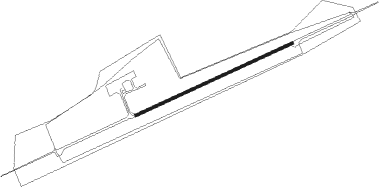
Runway info
| Runway 07 / 25 | ||
| length | 484m (1588ft) | |
| bearing | 76° / 256° | |
| width | 8m (26ft) | |
| surface | asphalt | |
Nearby beacons
| code | identifier | dist | bearing | frequency |
|---|---|---|---|---|
| TGO | TANGO TACAN | 16.7 | 288° | 112.50 |
| STG | STUTTGART VOR/DME | 19.3 | 298° | 116.85 |
| LUP | LAUPHEIM NDB | 19.9 | 136° | 407 |
| SGD | DME | 20 | 295° | 115.45 |
| LBU | LUBURG VOR/DME | 27.6 | 324° | 109.20 |
| SHD | HALL DME | 37.6 | 13° | 108.05 |
| ALD | (MEMMINGEN/ALLGAU) DME | 38.6 | 131° | 117.20 |
| ALG | ALLGAEU (MEMMINGEN) NDB | 39 | 129° | 341 |
| SUL | SULZ VOR | 40.1 | 263° | 116.10 |
| DKB | DINKELSBUEHL VORTAC | 45.4 | 43° | 117.80 |
| FHD | DME | 50 | 189° | 112.60 |
| KPT | KEMPTEN VOR/DME | 53.3 | 137° | 108.40 |
| NDD | DME-ILS | 55.3 | 20° | 108.70 |
| NSN | NIEDERSTETTEN NDB | 55.4 | 20° | 311 |
| NKR | NECKAR NDB | 61.7 | 313° | 292 |
| ANS | ANSBACH NDB | 62.5 | 51° | 452 |
| ZUE | ZURICH EAST VOR/DME | 63.5 | 222° | 110.05 |
| ILM | ILLESHEIM NDB | 65.6 | 38° | 488 |
Disclaimer
The information on this website is not for real aviation. Use this data with the X-Plane flight simulator only! Data taken with kind consent from X-Plane 12 source code and data files. Content is subject to change without notice.