Gerstetten
Airport details
| Country | Germany |
| State | Baden-Württemberg |
| Region | ED |
| Airspace | Munich Ctr |
| Municipality | Gerstetten |
| Elevation | 1975ft (602m) |
| Timezone | GMT +1 |
| Coordinates | 48.62111, 10.06111 |
| Magnetic var | |
| Type | land |
| Available since | X-Plane v10.40 |
| ICAO code | EDPT |
| IATA code | n/a |
| FAA code | n/a |
Communication
| Gerstetten Gerstetten Info | 123.000 |
Nearby Points of Interest:
Kloster Herbrechtingen
-Steiff-Fabrik
-Alter Bau
-Pfarrhof (Unterelchingen)
-Siechenkapelle
-Elchingen Abbey
-Pfarrhaus (Bächingen an der Brenz)
-Rathaus
-Altes Schulhaus Bargau
-Dorfschmiede (Haunsheim)
-Rectory (Pfuhl)
-Hauptstraße 43
-Jupitergigantensäule von Walheim
-Institutstraße 14
-Rathaus (Günzburg)
-Postamt Neresheim
-Rectory Bubesheim
-Stadthaus Ulm
-Reichenauer Hof
-Burg Klingenstein
-Ulmer Münz
-Bahnhof Neuoffingen
-St. Nemesius
-Söflingen Abbey
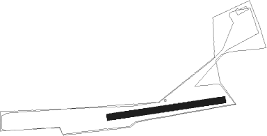
Runway info
| Runway 08 / 26 | ||
| length | 549m (1801ft) | |
| bearing | 87° / 267° | |
| width | 30m (98ft) | |
| surface | grass | |
Nearby beacons
| code | identifier | dist | bearing | frequency |
|---|---|---|---|---|
| LUP | LAUPHEIM NDB | 24.9 | 200° | 407 |
| SHD | HALL DME | 31.7 | 330° | 108.05 |
| TGO | TANGO TACAN | 31.8 | 270° | 112.50 |
| DKB | DINKELSBUEHL VORTAC | 32.1 | 19° | 117.80 |
| STG | STUTTGART VOR/DME | 32.2 | 275° | 116.85 |
| LBU | LUBURG VOR/DME | 33.4 | 292° | 109.20 |
| SGD | DME | 33.4 | 275° | 115.45 |
| AGB | AUGSBURG NDB | 36.6 | 103° | 318 |
| AUG | DME | 36.7 | 103° | 115.90 |
| ALG | ALLGAEU (MEMMINGEN) NDB | 38.3 | 162° | 341 |
| ALD | (MEMMINGEN/ALLGAU) DME | 38.5 | 165° | 117.20 |
| LCH | LECHFELD TACAN | 40.9 | 118° | 108.80 |
| NDD | DME-ILS | 46.5 | 353° | 108.70 |
| NSN | NIEDERSTETTEN NDB | 46.6 | 353° | 311 |
| ANS | ANSBACH NDB | 47 | 40° | 452 |
| ILM | ILLESHEIM NDB | 52.6 | 21° | 488 |
| KPT | KEMPTEN VOR/DME | 53.8 | 162° | 108.40 |
| FHD | DME | 61.4 | 210° | 112.60 |
| NUB | NUERNBERG VOR/DME | 65.3 | 48° | 115.75 |
Disclaimer
The information on this website is not for real aviation. Use this data with the X-Plane flight simulator only! Data taken with kind consent from X-Plane 12 source code and data files. Content is subject to change without notice.