Bamberg - Bamberg-breitenau
Airport details
| Country | Germany |
| State | Bavaria |
| Region | ED |
| Airspace | Munich Ctr |
| Municipality | Bamberg |
| Elevation | 811ft (247m) |
| Timezone | GMT +1 |
| Coordinates | 49.91707, 10.91254 |
| Magnetic var | |
| Type | land |
| Available since | X-Plane v10.32 |
| ICAO code | EDQA |
| IATA code | n/a |
| FAA code | n/a |
Communication
| Bamberg-Breitenau ATIS | 124.125 |
| Bamberg-Breitenau Bamberg Info | 120.175 |
Nearby Points of Interest:
Taharahaus
-Torwache
-Rathaus
-Bamberg
-Ottonianum (Bamberg)
-Schleusenwärterhaus Schleuse 100 in Bamberg
-Aufseesianum
-Wohnhaus
-Dr.-Remeis-Sternwarte
-Landhaus
-Synagoge
-Jewish ceremonial hall in Walsdorf (Oberfranken)
-Judenschule (Hirschaid)
-Burgstall Ketschenstein
-Turmhügel Seeleiten
-Turmhügel Obersenftenberg
-Burgstall Niedersenftenberg
-Stierfessel
-Mühle
-Torhaus
-Turmhügel Zoggendorf
-Burgstall Hoher Stein (Reckendorf)
-Schulgebäude
-Bürgerzentrum
Runway info
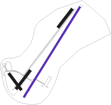
| Runway 03 / 21 | ||
| length | 1252m (4108ft) | |
| bearing | 49° / 229° | |
| width | 24m (77ft) | |
| surface | asphalt | |
| displ threshold | 243m (797ft) / 213m (699ft) | |
Runway 04 / 22  | ||
| length | 250m (820ft) | |
| bearing | 54° / 234° | |
| width | 35m (115ft) | |
| surface | grass | |
| Runway 05 / 23 | ||
| length | 250m (820ft) | |
| bearing | 54° / 234° | |
| width | 35m (115ft) | |
| surface | grass | |
| Runway 14 / 32 | ||
| length | 220m (722ft) | |
| bearing | 136° / 316° | |
| width | 35m (115ft) | |
| surface | grass | |
Nearby beacons
| code | identifier | dist | bearing | frequency |
|---|---|---|---|---|
| ERL | ERLANGEN VOR/DME | 18.2 | 138° | 114.90 |
| NUB | NUERNBERG VOR/DME | 25.3 | 164° | 115.75 |
| NGD | DME | 25.8 | 158° | 113.10 |
| BAY | BAYREUTH VOR | 28.2 | 85° | 110.60 |
| RTB | ROETHENBACH NDB | 29.2 | 142° | 415 |
| ILM | ILLESHEIM NDB | 33.6 | 230° | 488 |
| ANS | ANSBACH NDB | 38.1 | 205° | 452 |
| NSN | NIEDERSTETTEN NDB | 48.3 | 241° | 311 |
| NDD | DME-ILS | 48.5 | 241° | 108.70 |
| DKB | DINKELSBUEHL VORTAC | 53.4 | 221° | 117.80 |
| HFX | HOHENFELS NDB | 55.8 | 126° | 286 |
Departure and arrival routes
| Transition altitude | 5000ft |
| SID end points | distance | outbound heading | |
|---|---|---|---|
| RW03 | |||
| ANEL2E | 15mi | 115° | |
| SULU1E | 12mi | 311° | |
| RW21 | |||
| ANEL1W | 15mi | 115° | |
| SULU1W | 12mi | 311° | |
Instrument approach procedures
| runway | airway (heading) | route (dist, bearing) |
|---|---|---|
| RW03 | ANELA (295°) | ANELA 5000ft QA453 (6mi, 265°) 4500ft QA451 (5mi, 264°) 4000ft QA450 (6mi, 264°) 3500ft QA430 (3mi, 296°) 3500ft |
| RW03 | SULUS (131°) | SULUS 3500ft QA420 (17mi, 193°) 3500ft QA430 (3mi, 116°) 3500ft |
| RNAV | QA430 3500ft QA432 (4mi, 49°) 3500ft EDQA (8mi, 49°) 860ft QA107 (4mi, 48°) SULUS (11mi, 294°) 3000ft | |
| RW21 | ANELA (295°) | ANELA 5000ft QA455 (6mi, 346°) 4500ft QA457 (6mi, 346°) 4000ft QA459 (4mi, 346°) 3500ft QA439 (3mi, 276°) 3500ft |
| RW21 | SULUS (131°) | SULUS 3500ft QA429 (11mi, 87°) 3500ft QA439 (3mi, 115°) 3500ft |
| RNAV | QA439 3500ft QA437 (3mi, 229°) 3500ft EDQA (7mi, 228°) 871ft QA010 (1mi, 232°) QA011 (5mi, 282°) SULUS (9mi, 344°) 3000ft |
Disclaimer
The information on this website is not for real aviation. Use this data with the X-Plane flight simulator only! Data taken with kind consent from X-Plane 12 source code and data files. Content is subject to change without notice.