Bad Windsheim
Airport details
| Country | Germany |
| State | Bavaria |
| Region | ED |
| Airspace | Langen Ctr |
| Municipality | Bad Windsheim |
| Elevation | 1220ft (372m) |
| Timezone | GMT +1 |
| Coordinates | 49.51044, 10.36643 |
| Magnetic var | |
| Type | land |
| Available since | X-Plane v10.32 |
| ICAO code | EDQB |
| IATA code | n/a |
| FAA code | n/a |
Communication
| Bad Windsheim Windsheim Info | 118.260 |
Nearby Points of Interest:
Friedhofsmauer, ehemalige Wehrmauer
-Rathaus
-Wildbad
-Ansbacher Straße 26
-Zollhaus
-Amtsgericht Uffenheim
-Schloss Frankenberg
-Mariä Himmelfahrt
-Pferdeschwemme
-Kirchenburg
-Evangelisch-lutherisches Pfarrhaus (Gattenhofen)
-Kirche
-Bullenheim 47
-St. Peter und Paul (Gräfenbuch)
-Wohnhaus
-Amtshaus
-Pfarrkirche
-Bildstock
-Schloss
-Quelle Grundlos
-St. Nikolaus
-Gaden
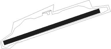
Runway info
| Runway 08 / 26 | ||
| length | 689m (2260ft) | |
| bearing | 81° / 261° | |
| width | 30m (98ft) | |
| surface | grass | |
Nearby beacons
| code | identifier | dist | bearing | frequency |
|---|---|---|---|---|
| ILM | ILLESHEIM NDB | 2.4 | 150° | 488 |
| ANS | ANSBACH NDB | 15.9 | 127° | 452 |
| NSN | NIEDERSTETTEN NDB | 17.1 | 254° | 311 |
| NDD | DME-ILS | 17.3 | 254° | 108.70 |
| DKB | DINKELSBUEHL VORTAC | 22.6 | 199° | 117.80 |
| NUB | NUERNBERG VOR/DME | 26 | 91° | 115.75 |
| NGD | DME | 27.8 | 91° | 113.10 |
| ERL | ERLANGEN VOR/DME | 31.7 | 80° | 114.90 |
| SHD | HALL DME | 33 | 236° | 108.05 |
| RTB | ROETHENBACH NDB | 34.6 | 92° | 415 |
| NEU | NEUBURG TACAN | 58.2 | 133° | 108.90 |
| WLD | WALDA VOR/DME | 63.4 | 141° | 112.80 |
Disclaimer
The information on this website is not for real aviation. Use this data with the X-Plane flight simulator only! Data taken with kind consent from X-Plane 12 source code and data files. Content is subject to change without notice.