Giebelstadt
Airport details
| Country | Germany |
| State | Bavaria |
| Region | ED |
| Airspace | Langen Ctr |
| Municipality | Giebelstadt |
| Elevation | 979ft (298m) |
| Timezone | GMT +1 |
| Coordinates | 49.64813, 9.96648 |
| Magnetic var | |
| Type | land |
| Available since | X-Plane v10.40 |
| ICAO code | EDQG |
| IATA code | GHF |
| FAA code | n/a |
Communication
| Giebelstadt Giebelstadt Info | 122.500 |
Nearby Points of Interest:
Kirche
-Synagoge
-Skulpturengruppe
-Pfarrgasse 12
-Schloß
-Torturm
-Wohngebäude
-Zehntscheune
-Gasthaus
-Schmiede
-Rathaus
-Mariensäule
-Amtsgericht
-Hauptstraße 44
-Pfarrkirche
-Kreuzweg
-Johanniterkastell
-Krananlage
-Pförtleinsgasse 10 (Marktbreit)
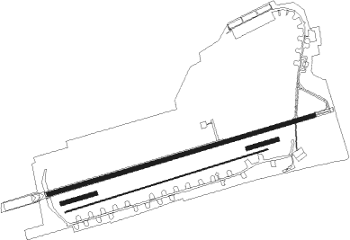
Runway info
Runway 08 / 26  | ||
| length | 1977m (6486ft) | |
| bearing | 82° / 262° | |
| width | 30m (98ft) | |
| surface | concrete | |
| displ threshold | 135m (443ft) / 100m (328ft) | |
| Runway 07 / 25 | ||
| length | 218m (715ft) | |
| bearing | 82° / 262° | |
| width | 30m (98ft) | |
| surface | grass | |
| Runway 07L / 25R | ||
| length | 1517m (4977ft) | |
| bearing | 82° / 262° | |
| width | 5m (16ft) | |
| surface | grass | |
| Runway 07C / 25C | ||
| length | 248m (814ft) | |
| bearing | 82° / 262° | |
| width | 30m (98ft) | |
| surface | grass | |
Nearby beacons
| code | identifier | dist | bearing | frequency |
|---|---|---|---|---|
| NDD | DME-ILS | 15.2 | 181° | 108.70 |
| NSN | NIEDERSTETTEN NDB | 15.2 | 180° | 311 |
| ILM | ILLESHEIM NDB | 19.5 | 113° | 488 |
| DKB | DINKELSBUEHL VORTAC | 32.1 | 152° | 117.80 |
| SHD | HALL DME | 32.7 | 200° | 108.05 |
| ANS | ANSBACH NDB | 32.9 | 117° | 452 |
| CHA | CHARLIE VOR/DME | 39.4 | 286° | 115.35 |
| LBU | LUBURG VOR/DME | 50.5 | 220° | 109.20 |
| GED | GEDERN VORTAC | 53.5 | 317° | 110.80 |
| FUL | FULDA VOR/DME | 58.7 | 337° | 112.10 |
| STG | STUTTGART VOR/DME | 63.5 | 217° | 116.85 |
| SGD | DME | 64.6 | 218° | 115.45 |
Departure and arrival routes
| Transition altitude | 5000ft |
| SID end points | distance | outbound heading | |
|---|---|---|---|
| RW08 | |||
| TAKU2E | 17mi | 150° | |
| RW26 | |||
| TAKU2W | 17mi | 150° | |
Instrument approach procedures
| runway | airway (heading) | route (dist, bearing) |
|---|---|---|
| RW08 | COSJE (164°) | COSJE 5000ft QG080 (10mi, 265°) QG081 (4mi, 262°) 5000ft QG082 (5mi, 161°) 4400ft |
| RNAV | QG082 4400ft GIPAV (4mi, 82°) 4000ft EDQG (10mi, 82°) 1027ft QG083 (7mi, 82°) (3029mi, 192°) 2500ft COSJE (3030mi, 11°) 5000ft | |
| RW26 | COSJE (164°) | COSJE 5000ft QG260 (10mi, 79°) QG261 (3mi, 82°) 5000ft QG262 (5mi, 162°) 4600ft |
| RNAV | QG262 4600ft SODGU (3mi, 262°) 4000ft EDQG (10mi, 262°) 1028ft QG263 (7mi, 262°) 2500ft (3023mi, 191°) 2500ft COSJE (3030mi, 11°) 5000ft |
Disclaimer
The information on this website is not for real aviation. Use this data with the X-Plane flight simulator only! Data taken with kind consent from X-Plane 12 source code and data files. Content is subject to change without notice.