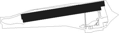
Kulmbach
Airport details
| Country | Germany |
| State | Bavaria |
| Region | ED |
| Airspace | Munich Ctr |
| Municipality | Kulmbach |
| Elevation | 1660ft (506m) |
| Timezone | GMT +1 |
| Coordinates | 50.13500, 11.45867 |
| Magnetic var | |
| Type | land |
| Available since | X-Plane v10.40 |
| ICAO code | EDQK |
| IATA code | n/a |
| FAA code | n/a |
Communication
| Kulmbach Kulmbach Info | 118.525 |
Nearby Points of Interest:
Reh-Tower
-Schloss
-Schlosskirche
-Ruine Wartenfels
-Burg Wildenstein (Presseck)
-Steinachklamm
-Pfarrkirche
-Cultural heritage D-4-77-163-30 in Wirsberg
-Marienkirche (Himmelkron)
-Burg Lindenberg
-Bürgerzentrum
-Rathaus
-Magnus-Tower
-Baudenkmal
-Synagoge
-St. Georg
-Wasserschloss Tüschnitz
-Bildstock
-Rodacher Straße 2 (Kronach)
-Burg Waldenfels
-Bildstock (Wallenfels, Schützenstraße)
-Wohnhaus

Nearby beacons
| code | identifier | dist | bearing | frequency |
|---|---|---|---|---|
| BAY | BAYREUTH VOR | 11.3 | 130° | 110.60 |
| ERL | ERLANGEN VOR/DME | 31.1 | 213° | 114.90 |
| GRW | GRAFENWOHR NDB | 32.3 | 132° | 405 |
| GRF | GRAFENWOHR TACAN | 32.4 | 133° | 111.80 |
| OKG | CHEB VOR/DME | 36.7 | 94° | 115.70 |
| RTB | ROETHENBACH NDB | 39.9 | 198° | 415 |
| NGD | DME | 40.7 | 211° | 113.10 |
| NUB | NUERNBERG VOR/DME | 41.3 | 214° | 115.75 |
| ERF | ERFURT VOR/DME | 49.7 | 345° | 113.85 |
| EFD | DME | 54.3 | 329° | 112.05 |
| HFX | HOHENFELS NDB | 57.2 | 156° | 286 |
| ANS | ANSBACH NDB | 59 | 225° | 452 |
Disclaimer
The information on this website is not for real aviation. Use this data with the X-Plane flight simulator only! Data taken with kind consent from X-Plane 12 source code and data files. Content is subject to change without notice.