Weiden In Der Oberpfalz - Weiden
Airport details
| Country | Germany |
| State | Bavaria |
| Region | ED |
| Airspace | Munich Ctr |
| Municipality | Weiden in der Oberpfalz |
| Elevation | 1328ft (405m) |
| Timezone | GMT +1 |
| Coordinates | 49.67981, 12.11643 |
| Magnetic var | |
| Type | land |
| Available since | X-Plane v10.40 |
| ICAO code | EDQW |
| IATA code | n/a |
| FAA code | n/a |
Communication
| Weiden Weiden Info | 120.250 |
Nearby Points of Interest:
Schloss Rupprechtsreuth
-Burgstall Keckenburg
-Neues Schloss
-Heilige Familie (Weiherhammer)
-St. Georg (Neustadt an der Waldnaab)
-Altes Schloss
-Schloss Steinfels
-Bahnhof Störnstein
-Floß Marktplatz 2
-Katholische Pfarrkirche
-Podewilshaus Floß
-Pflegschloss Floß
-St. Martin (Kaltenbrunn)
-Katholische Kirche Maria Hilf
-Kommunbrauhaus
-Schlossberg in Waldau
-Schloss Waldau
-Micherlmarterl
-Neues Schloss Waldthurn
-Rathaus Grafenwöhr
-Wehrkirche Ehenfeld
-Pfarrkirche Ehenfeld
-Vohenstrauß station
-Kapelle St. Josef
Runway info
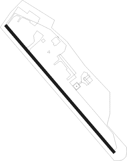
| Runway 14 / 32 | ||
| length | 571m (1873ft) | |
| bearing | 132° / 312° | |
| width | 10m (33ft) | |
| surface | asphalt | |
| displ threshold | 100m (328ft) / 0m (0ft) | |
Nearby beacons
| code | identifier | dist | bearing | frequency |
|---|---|---|---|---|
| GRW | GRAFENWOHR NDB | 6.8 | 275° | 405 |
| GRF | GRAFENWOHR TACAN | 6.9 | 274° | 111.80 |
| OKG | CHEB VOR/DME | 25.7 | 37° | 115.70 |
| BAY | BAYREUTH VOR | 26.1 | 302° | 110.60 |
| HFX | HOHENFELS NDB | 29.4 | 209° | 286 |
| RTB | ROETHENBACH NDB | 35.6 | 257° | 415 |
| ERL | ERLANGEN VOR/DME | 37.5 | 269° | 114.90 |
| RDG | RODING VOR/DME | 41.6 | 147° | 114.70 |
| L | VRATA (KARLOVY VARY) NDB | 44.4 | 58° | 365 |
| IGL | INGOLSTADT NDB | 59.5 | 207° | 345 |
| IGL | INGOLSTADT TACAN | 61.6 | 210° | 111.40 |
| NEU | NEUBURG TACAN | 68 | 223° | 108.90 |
Disclaimer
The information on this website is not for real aviation. Use this data with the X-Plane flight simulator only! Data taken with kind consent from X-Plane 12 source code and data files. Content is subject to change without notice.