Neunkirchen Am Brand - Hetzleser Berg
Airport details
| Country | Germany |
| State | Bavaria |
| Region | ED |
| Airspace | Munich Ctr |
| Municipality | Neunkirchen a.Brand |
| Elevation | 1749ft (533m) |
| Timezone | GMT +1 |
| Coordinates | 49.64222, 11.16167 |
| Magnetic var | |
| Type | land |
| Available since | X-Plane v10.40 |
| ICAO code | EDQX |
| IATA code | n/a |
| FAA code | n/a |
Communication
| Hetzleser Berg Hetzleser Berg Info | 123.005 |
Nearby Points of Interest:
Burgruine
-Augustinerchorherrenstift Neunkirchen am Brand
-Kasberger Linde
-Tanzlinde
-Bürgerhaus
-Pfarrkirche
-St. Jakobus (Marloffstein)
-Sinterterrassen an der Lillach ESE von Weißenohe
-Ehemaliges Muffelsches Schloss
-Ehemaliges Gasthaus Zum Schloss
-Burgstall Dörnhof
-Evangelisch-lutherisches Pfarrhaus
-Egloffsteiner Felsenkeller
-St. Andreas
-Rathaus
-Kleinseebacher Mühle
-Burgstall Altes Schloss (Affalterthal)
-Burgstall Altes Schloss
-Wasserfall bei Äpfelbach
-Burgberg
-Pfalz
-Torwache
-Werner-von-Siemens-Straße 24, 26, 28
-Deutsch-reformierte Kirche
-Rokokohaus
Runway info
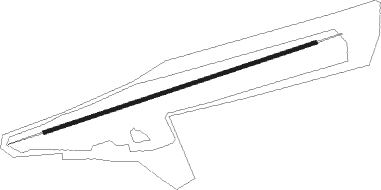
| Runway 08 / 26 | ||
| length | 608m (1995ft) | |
| bearing | 81° / 261° | |
| width | 7m (23ft) | |
| surface | asphalt | |
| displ threshold | 80m (262ft) / 0m (0ft) | |
Nearby beacons
| code | identifier | dist | bearing | frequency |
|---|---|---|---|---|
| ERL | ERLANGEN VOR/DME | 0.8 | 321° | 114.90 |
| NGD | DME | 9 | 210° | 113.10 |
| NUB | NUERNBERG VOR/DME | 9.7 | 222° | 115.75 |
| RTB | ROETHENBACH NDB | 10.2 | 150° | 415 |
| BAY | BAYREUTH VOR | 27.6 | 54° | 110.60 |
| ANS | ANSBACH NDB | 28.7 | 238° | 452 |
| GRF | GRAFENWOHR TACAN | 30.3 | 86° | 111.80 |
| GRW | GRAFENWOHR NDB | 30.4 | 86° | 405 |
| ILM | ILLESHEIM NDB | 31.8 | 258° | 488 |
| HFX | HOHENFELS NDB | 37.2 | 121° | 286 |
| DKB | DINKELSBUEHL VORTAC | 46.9 | 242° | 117.80 |
| NEU | NEUBURG TACAN | 55.8 | 177° | 108.90 |
| IGL | INGOLSTADT NDB | 57.5 | 152° | 345 |
| IGL | INGOLSTADT TACAN | 57.7 | 156° | 111.40 |
Disclaimer
The information on this website is not for real aviation. Use this data with the X-Plane flight simulator only! Data taken with kind consent from X-Plane 12 source code and data files. Content is subject to change without notice.