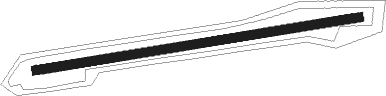
Pegnitz - Pegnitz-zipser Berg
Airport details
| Country | Germany |
| State | Bavaria |
| Region | ED |
| Airspace | Munich Ctr |
| Municipality | Pegnitz |
| Elevation | 1791ft (546m) |
| Timezone | GMT +1 |
| Coordinates | 49.76217, 11.57467 |
| Magnetic var | |
| Type | land |
| Available since | X-Plane v10.40 |
| ICAO code | EDQZ |
| IATA code | n/a |
| FAA code | n/a |
Communication
| Pegnitz-Zipser Berg Pegnitz Info | 132.025 |
Nearby Points of Interest:
Burgruine Steinamwasser
-Michelfeld Abbey
-Quellaustritt Seeweiher (D68) WSW von Michelfeld
-Turmhügel Altencreußen
-Ensemble Auerbach in der Oberpfalz
-Pfarrhaus in Auerbach in der Oberpfalz
-St. Thomas von Aquin
-Rathaus
-Saalburg mit Höhlen (D125) SE von Plech
-St. Johannes Evangelist
-Burgstall Leuenstein
-Burgstall Leupoldstein
-Burgstall Oberntüchersfeld
-Burgstall im Eibental
-Burgstall Oberailsfeld
-Chapel Kugelau
-Bismarckgrotte bei Rinnenbrunn
-Burgstall Im alten Haus
-Giebelbau
-Pfarrhaus
-Gemeindebrauhaus
-Friedhofkirche Mater Dolorosa
-Uhrturm in Rupprechtstegen
-Burgstall auf der Hasenleite
-Burgstall Altes Haus (Hirschbach)
Nearby beacons
| code | identifier | dist | bearing | frequency |
|---|---|---|---|---|
| BAY | BAYREUTH VOR | 13.6 | 16° | 110.60 |
| GRF | GRAFENWOHR TACAN | 14.7 | 101° | 111.80 |
| GRW | GRAFENWOHR NDB | 14.8 | 100° | 405 |
| ERL | ERLANGEN VOR/DME | 17.6 | 256° | 114.90 |
| RTB | ROETHENBACH NDB | 20.9 | 229° | 415 |
| NGD | DME | 24.8 | 242° | 113.10 |
| NUB | NUERNBERG VOR/DME | 26.1 | 244° | 115.75 |
| HFX | HOHENFELS NDB | 34.4 | 152° | 286 |
| OKG | CHEB VOR/DME | 36.9 | 70° | 115.70 |
| ANS | ANSBACH NDB | 45.7 | 244° | 452 |
| RDG | RODING VOR/DME | 57.1 | 127° | 114.70 |
Disclaimer
The information on this website is not for real aviation. Use this data with the X-Plane flight simulator only! Data taken with kind consent from X-Plane 12 source code and data files. Content is subject to change without notice.