Mendig
Airport details
| Country | Germany |
| State | Rhineland-Palatinate |
| Region | ED |
| Airspace | Langen Ctr |
| Municipality | Mendig |
| Elevation | 597ft (182m) |
| Timezone | GMT +1 |
| Coordinates | 50.36600, 7.31533 |
| Magnetic var | |
| Type | land |
| Available since | X-Plane v10.40 |
| ICAO code | EDRE |
| IATA code | n/a |
| FAA code | n/a |
Communication
| Mendig Mendig Info | 135.060 |
Nearby Points of Interest:
Jüdischer Friedhof
-Amtsgericht Mayen
-Synagoge Polch
-Burghaus Wassenach
-Krahnenberg-Kaserne
-Schloss Burgbrohl
-Wallfahrtskirche zum Heiligen Kreuz
-Jüdischer Friedhof Niederzissen
-Mennonitenkirche Neuwied
-Kolliger Mühle
-Alte Kapelle
-Wayside Shrine
-St. Thekla
-Kriegerdenkmal
-Jüdischer Friedhof Rheineck
-Sinziger Straße 9 in Waldorf
-Kreuzkapelle
-Jewish cemetery, Niederbieber
-Villa Lucia
-Kriegerdenkmal 1870/71
-Schloss Monrepos
-St. Cornelius und Cyprianus
-Stadtbefestigung Alken (Untermosel)
-Weidtmansches Schlösschen
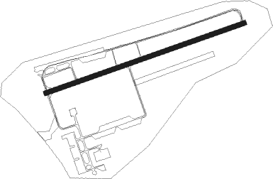
Runway info
| Runway 07 / 25 | ||
| length | 1629m (5344ft) | |
| bearing | 80° / 260° | |
| width | 36m (118ft) | |
| surface | asphalt | |
Nearby beacons
| code | identifier | dist | bearing | frequency |
|---|---|---|---|---|
| BUE | BUECHEL TACAN | 14.6 | 233° | 117.10 |
| HAN | HAHN NDB | 24.1 | 185° | 376 |
| FHH | DME | 25.5 | 187° | 117.35 |
| LV | COLOGNE-BONN NDB | 26.4 | 350° | 327 |
| COL | COLA VOR/DME | 27.2 | 34° | 108.80 |
| KBO | COLOGNE-BONN VOR/DME | 30.4 | 341° | 112.15 |
| LW | COLOGNE-BONN NDB | 32 | 353° | 300 |
| SPA | SPANGDAHLEM TACAN | 33.2 | 238° | 109.50 |
| TAU | TAUNUS VOR/DME | 33.2 | 98° | 113.35 |
| LJ | COLOGNE-BONN NDB | 35 | 336° | 365 |
| SLD | DME | 35.6 | 66° | 108.05 |
| SIL | SIEGERLAND NDB | 36.6 | 69° | 489 |
| WNN | DME | 37.4 | 306° | 109.85 |
| NVO | NOERVENICH VORTAC | 37.7 | 304° | 116.20 |
| WYP | WIPPER VOR | 41 | 357° | 109.60 |
| WIB | WIESBADEN TACAN | 42.8 | 108° | 114.10 |
| GMH | GERMINGHAUSEN VOR/DME | 53 | 36° | 115.40 |
| ELU | LUXEMBOURG NDB | 55.4 | 234° | 368 |
| RMS | RAMSTEIN TACAN | 56.8 | 164° | 113.40 |
| DY | DUESSELDORF NDB | 57.8 | 323° | 284 |
| BAM | BARMEN VOR/DME | 57.9 | 352° | 114 |
| DUS | DUESSELDORF VOR/DME | 59 | 329° | 115.15 |
| MHD | DME | 60.8 | 317° | 112.50 |
| MHV | MOENCHENGLADBACH VOR | 60.9 | 317° | 109.80 |
| LI | DUESSELDORF NDB | 61 | 337° | 417 |
Disclaimer
The information on this website is not for real aviation. Use this data with the X-Plane flight simulator only! Data taken with kind consent from X-Plane 12 source code and data files. Content is subject to change without notice.