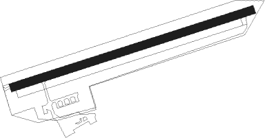
Bad Dürkheim - Bad Duerkheim
Airport details
| Country | Germany |
| State | Rhineland-Palatinate |
| Region | ED |
| Airspace | Langen Ctr |
| Municipality | Bad Dürkheim |
| Elevation | 351ft (107m) |
| Timezone | GMT +1 |
| Coordinates | 49.47300, 8.19633 |
| Magnetic var | |
| Type | land |
| Available since | X-Plane v10.32 |
| ICAO code | EDRF |
| IATA code | n/a |
| FAA code | n/a |
Communication
| Bad Duerkheim Duerkheim Info | 122.400 |
Nearby beacons
| code | identifier | dist | bearing | frequency |
|---|---|---|---|---|
| MND | DME | 12.4 | 90° | 113.55 |
| NKR | NECKAR NDB | 22.5 | 104° | 292 |
| RID | RIED VOR/DME | 22.8 | 48° | 112.20 |
| RMS | RAMSTEIN TACAN | 23.9 | 266° | 113.40 |
| VFM | NAUHEIM VOR | 31.2 | 29° | 113.75 |
| KRH | KARLSRUHE VOR/DME | 32.5 | 141° | 115.95 |
| FW | FRANKFURT NDB | 33.2 | 24° | 382 |
| ZWN | ZWEIBRUECKEN VOR/DME | 33.7 | 253° | 114.80 |
| WIB | WIESBADEN TACAN | 34.7 | 11° | 114.10 |
| FRD | DME | 36.4 | 34° | 115.90 |
| FFM | FRANKFURT VORTAC | 38.8 | 37° | 114.20 |
| FR | FRANKFURT NDB | 40.3 | 39° | 297 |
| KBA | KARLSRUHE/BADEN-BADEN NDB | 40.7 | 188° | 431 |
| SR | ENSHEIM (SAARBRUECKEN) NDB | 41.1 | 255° | 360 |
| KBD | DME | 41.8 | 189° | 115.80 |
| CHA | CHARLIE VOR/DME | 42.4 | 62° | 115.35 |
| FHH | DME | 45.9 | 297° | 117.35 |
| HAN | HAHN NDB | 46.2 | 298° | 376 |
| TAU | TAUNUS VOR/DME | 46.7 | 358° | 113.35 |
| SAV | SAVERNE VOR/DME | 50.1 | 228° | 110.45 |
| MTR | METRO VOR | 54.4 | 39° | 110 |
| SE | STRASBOURG NDB | 56.3 | 209° | 412 |
| PHG | PHALSBOURG NDB | 57.7 | 235° | 424 |
| STR | STRASBOURG ENTZHEIM VOR/DME | 63.1 | 213° | 115.60 |
Disclaimer
The information on this website is not for real aviation. Use this data with the X-Plane flight simulator only! Data taken with kind consent from X-Plane 12 source code and data files. Content is subject to change without notice.
