Saarlouis - Saarlouis - Dueren
Airport details
| Country | Germany |
| State | Saarland |
| Region | ED |
| Airspace | Langen Ctr |
| Municipality | Wallerfangen |
| Elevation | 1118ft (341m) |
| Timezone | GMT +1 |
| Coordinates | 49.31250, 6.67400 |
| Magnetic var | |
| Type | land |
| Available since | X-Plane v10.40 |
| ICAO code | EDRJ |
| IATA code | n/a |
| FAA code | n/a |
Communication
| Saarlouis - Dueren Saarlouis Info | 122.600 |
Nearby Points of Interest:
Former synagogue in Wallerfangen
-St. Martin
-Rathaus Saarlouis
-Stadthalle Dillingen
-Villa Alhambra (Dillingen)
-Wendalinus-Kapelle
-St. Martin (Schwalbach (Saar))
-St. Katharina
-Grube Düppenweiler
-St. Agatha
-Friedenskirche
-Uhrenmuseum
-St. Blasius
-Heilig-Kreuz-Kirche
-Ossuaire de Boucheporn
-Biereiche
-Aschbachkirche
-Ölmühle Berschweiler
-Église Notre-Dame du Wiesberg
-Château d'Hausen
-Schlossberg Stadium
-puits Sainte-Marthe
-Château de Hellering
-Evangelische Pfarrkirche Wahlschied
-St. Nikolaus
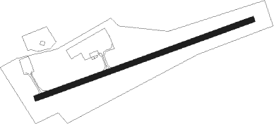
Runway info
| Runway 07 / 25 | ||
| length | 797m (2615ft) | |
| bearing | 80° / 260° | |
| width | 20m (66ft) | |
| surface | asphalt | |
Nearby beacons
| code | identifier | dist | bearing | frequency |
|---|---|---|---|---|
| MTZ | METZ NDB | 18.3 | 266° | 354 |
| SAD | DME | 18.3 | 103° | 116.75 |
| GTQ | GROSTENQUIN VOR/DME | 19.6 | 173° | 111.25 |
| SR | ENSHEIM (SAARBRUECKEN) NDB | 22.1 | 100° | 360 |
| LOU | LORRAINE NDB | 24.6 | 232° | 388 |
| ELU | LUXEMBOURG NDB | 25.3 | 319° | 368 |
| LE | LUXEMBOURG NDB | 25.7 | 308° | 318 |
| LUX | LUXEMBOURG VOR/DME | 25.7 | 307° | 112.25 |
| LW | LUXEMBOURG NDB | 26.5 | 301° | 404 |
| WLU | LUXEMBOURG NDB | 28.6 | 292° | 346 |
| ZWN | ZWEIBRUECKEN VOR/DME | 29.5 | 96° | 114.80 |
| RMS | RAMSTEIN TACAN | 36.3 | 82° | 113.40 |
| PHG | PHALSBOURG NDB | 38.7 | 136° | 424 |
| DIK | DIEKIRCH NDB | 39.1 | 315° | 307 |
| ETN | ETAIN NDB | 39.4 | 265° | 410 |
| SPA | SPANGDAHLEM TACAN | 40 | 2° | 109.50 |
| SAV | SAVERNE VOR/DME | 43.4 | 124° | 110.45 |
| FHH | DME | 44.1 | 43° | 117.35 |
| HAN | HAHN NDB | 45.7 | 43° | 376 |
| NAY | NANCY OCHEY TACAN | 52.2 | 225° | 116.80 |
| BUE | BUECHEL TACAN | 54.2 | 25° | 117.10 |
| STR | STRASBOURG ENTZHEIM VOR/DME | 60 | 132° | 115.60 |
| EMT | EPINAL NDB | 61.8 | 206° | 419 |
| EPL | EPINAL MIRECOURT VOR | 64.4 | 212° | 113 |
Disclaimer
The information on this website is not for real aviation. Use this data with the X-Plane flight simulator only! Data taken with kind consent from X-Plane 12 source code and data files. Content is subject to change without notice.