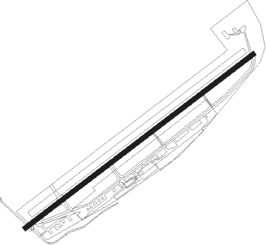
Koblenz - Koblenz - Winningen
Airport details
| Country | Germany |
| State | Rhineland-Palatinate |
| Region | ED |
| Airspace | Langen Ctr |
| Municipality | Winningen |
| Elevation | 639ft (195m) |
| Timezone | GMT +1 |
| Coordinates | 50.32406, 7.52801 |
| Magnetic var | |
| Type | land |
| Available since | X-Plane v10.40 |
| ICAO code | EDRK |
| IATA code | ZNV |
| FAA code | n/a |
Communication
| Koblenz - Winningen Koblenz Info | 122.650 |
Nearby Points of Interest:
Salesianerinnenkloster Koblenz
-Hübeling Blockhouse
-Weidtmansches Schlösschen
-Feste Kaiser Alexander
-Kriegerdenkmal
-Jewish Cemetery, Koblenz
-Synagogue
-Friedrich-Mohr-Denkmal
-Kaiserliche Oberpostdirektion (Koblenz)
-Haus Cuno
-Vier Türme
-Ehemalige Stadtkommandantur Koblenz
-Michaelskapelle
-Alte Oberpostdirektion (Koblenz)
-Oberpräsidium Rheinprovinz (Koblenz)
-Bürresheimer Hof (Koblenz)
-Dreikönigenhaus
-Schöffenhaus (Koblenz)
-Krämerzunfthaus
-Landeshauptarchiv Koblenz
-Falckenstein barracks
-St. Jakobus
-Goeben-Denkmal in Koblenz
-Floating bridge in Koblenz
-Kastorbrunnen
Nearby beacons
| code | identifier | dist | bearing | frequency |
|---|---|---|---|---|
| BUE | BUECHEL TACAN | 19.6 | 252° | 117.10 |
| HAN | HAHN NDB | 23.5 | 215° | 376 |
| TAU | TAUNUS VOR/DME | 24.7 | 97° | 113.35 |
| FHH | DME | 25.1 | 215° | 117.35 |
| COL | COLA VOR/DME | 27.7 | 8° | 108.80 |
| LV | COLOGNE-BONN NDB | 30.8 | 329° | 327 |
| SLD | DME | 31.1 | 55° | 108.05 |
| SIL | SIEGERLAND NDB | 31.6 | 60° | 489 |
| WIB | WIESBADEN TACAN | 34.4 | 110° | 114.10 |
| KBO | COLOGNE-BONN VOR/DME | 35.4 | 325° | 112.15 |
| LW | COLOGNE-BONN NDB | 36 | 334° | 300 |
| SPA | SPANGDAHLEM TACAN | 38 | 247° | 109.50 |
| FW | FRANKFURT NDB | 39.6 | 109° | 382 |
| LJ | COLOGNE-BONN NDB | 40.3 | 322° | 365 |
| VFM | NAUHEIM VOR | 42.3 | 111° | 113.75 |
| WYP | WIPPER VOR | 44.5 | 341° | 109.60 |
| WNN | DME | 44.8 | 301° | 109.85 |
| NVO | NOERVENICH VORTAC | 45.3 | 299° | 116.20 |
| GMH | GERMINGHAUSEN VOR/DME | 52.6 | 23° | 115.40 |
| RMS | RAMSTEIN TACAN | 53.4 | 176° | 113.40 |
| DY | DUESSELDORF NDB | 63.9 | 316° | 284 |
| MND | DME | 63.9 | 131° | 113.55 |
| DUS | DUESSELDORF VOR/DME | 64.6 | 321° | 115.15 |
Disclaimer
The information on this website is not for real aviation. Use this data with the X-Plane flight simulator only! Data taken with kind consent from X-Plane 12 source code and data files. Content is subject to change without notice.