Pirmasens
Airport details
| Country | Germany |
| State | Rhineland-Palatinate |
| Region | ED |
| Airspace | Langen Ctr |
| Municipality | Rieschweiler-Mühlbach |
| Elevation | 1247ft (380m) |
| Timezone | GMT +1 |
| Coordinates | 49.26567, 7.49083 |
| Magnetic var | |
| Type | land |
| Available since | X-Plane v10.40 |
| ICAO code | EDRP |
| IATA code | n/a |
| FAA code | n/a |
Communication
| Pirmasens Pirmasens Info | 122.350 |
| Pirmasens Langen Information | 123.525 |
| Pirmasens Zweibruecken Info | 123.825 |
Nearby Points of Interest:
Maria Königin der Engel
-Kriegerdenkmal (Winterbach)
-Protestant church Nünschweiler
-Jüdischer Friedhof Herschberg
-War memorial Höhfröschen
-Jüdischer Friedhof Wallhalben
-St. Martin Großbundenbach
-Lustschloss Tschifflik
-Villa Ipser
-Lustschloss Monbijou
-Jewish cemetery Rodalben
-Kriegerdenkmal (Dietrichingen)
-Neues Rathaus (Pirmasens)
-Sankt Pirminius Church in Pirmasens
-Neuffer (Schuhfabrik)
-Bahnmeisterei Homburg
-St. Philipp und Jakob
-Kriegerdenkmal
-Eichelscheiderhof
-Elisabethkirche (Limbach (Kirkel))
-Protestantische Pfarrkirche
-Synagoge
-Protestantische Kirche
-Amtsgericht Landstuhl
-Schönenberg-Kübelberg railway station
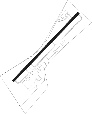
Runway info
| Runway 05 / 23 | ||
| length | 801m (2628ft) | |
| bearing | 60° / 240° | |
| width | 20m (66ft) | |
| surface | asphalt | |
| displ threshold | 0m (0ft) / 57m (187ft) | |
Nearby beacons
| code | identifier | dist | bearing | frequency |
|---|---|---|---|---|
| ZWN | ZWEIBRUECKEN VOR/DME | 3.6 | 243° | 114.80 |
| RMS | RAMSTEIN TACAN | 10.8 | 29° | 113.40 |
| SR | ENSHEIM (SAARBRUECKEN) NDB | 11 | 260° | 360 |
| SAD | DME | 15 | 262° | 116.75 |
| SAV | SAVERNE VOR/DME | 28.2 | 185° | 110.45 |
| PHG | PHALSBOURG NDB | 32 | 210° | 424 |
| GTQ | GROSTENQUIN VOR/DME | 34.7 | 250° | 111.25 |
| KBA | KARLSRUHE/BADEN-BADEN NDB | 36.8 | 128° | 431 |
| KBD | DME | 37.4 | 129° | 115.80 |
| FHH | DME | 41.5 | 341° | 117.35 |
| SE | STRASBOURG NDB | 41.5 | 162° | 412 |
| HAN | HAHN NDB | 42.7 | 343° | 376 |
| STR | STRASBOURG ENTZHEIM VOR/DME | 45.7 | 174° | 115.60 |
| SPA | SPANGDAHLEM TACAN | 52.7 | 312° | 109.50 |
| LRD | DME | 55.7 | 160° | 108.05 |
| LHR | LAHR NDB | 56.5 | 161° | 337 |
| VFM | NAUHEIM VOR | 56.5 | 55° | 113.75 |
| WIB | WIESBADEN TACAN | 56.6 | 46° | 114.10 |
| BUE | BUECHEL TACAN | 57.2 | 335° | 117.10 |
| FW | FRANKFURT NDB | 57.4 | 52° | 382 |
| TAU | TAUNUS VOR/DME | 64.6 | 34° | 113.35 |
Disclaimer
The information on this website is not for real aviation. Use this data with the X-Plane flight simulator only! Data taken with kind consent from X-Plane 12 source code and data files. Content is subject to change without notice.