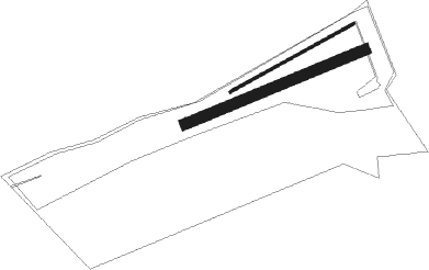
Aremberg - Wershofen
Airport details
| Country | Germany |
| State | Rhineland-Palatinate |
| Region | ED |
| Airspace | Langen Ctr |
| Municipality | Wershofen |
| Elevation | 1581ft (482m) |
| Timezone | GMT +1 |
| Coordinates | 50.45183, 6.78600 |
| Magnetic var | |
| Type | land |
| Available since | X-Plane v10.40 |
| ICAO code | EDRV |
| IATA code | n/a |
| FAA code | n/a |
Communication
| Wershofen Wershofen Info | 122.400 |
Nearby Points of Interest:
Ehemalige Kapelle St. Antonius Eremita
-Burgmannenhaus (Aremberg)
-St. Martin (Freilingen)
-St. Rochus (Rodder)
-St. Stephan
-St. Rochus und Sebastian
-St. Agatha und Lutger (Lückenbach)
-Georgstor
-Kreuzkapelle Blankenheim (Ahr)
-Burghaus Burgsahr
-Tempelheiligtum Zingsheim
-St. Barbara und Helena
-St. Gertrud
-St. Nikolaus
-Kapelle Walporzheimer Straße (Ahrweiler)
-Alt St. Thomas
-St. Rochus and Sebastian
-St Peter's Chapel
-St. Servatius und Dorothea
-Hubertusstraße 2
-Haus Rath
-St. Wendalinus (Jammelshofen)
-Jüdischer Friedhof Dernau
-St. Michael
-Jüdischer Friedhof

Nearby beacons
| code | identifier | dist | bearing | frequency |
|---|---|---|---|---|
| BUE | BUECHEL TACAN | 19.6 | 134° | 117.10 |
| NVO | NOERVENICH VORTAC | 22.9 | 338° | 116.20 |
| WNN | DME | 23.4 | 343° | 109.85 |
| LV | COLOGNE-BONN NDB | 27.3 | 52° | 327 |
| KBO | COLOGNE-BONN VOR/DME | 28.1 | 41° | 112.15 |
| SPA | SPANGDAHLEM TACAN | 28.6 | 191° | 109.50 |
| LJ | COLOGNE-BONN NDB | 30.4 | 30° | 365 |
| LW | COLOGNE-BONN NDB | 32.1 | 46° | 300 |
| SLV | SPA NDB | 33.4 | 272° | 386 |
| HAN | HAHN NDB | 34.8 | 135° | 376 |
| FHH | DME | 35.6 | 137° | 117.35 |
| COL | COLA VOR/DME | 36.6 | 68° | 108.80 |
| WYP | WIPPER VOR | 40.4 | 40° | 109.60 |
| GIX | GEILENKIRCHEN TACAN | 41.6 | 305° | 108.10 |
| DIK | DIEKIRCH NDB | 43.5 | 228° | 307 |
| MAS | MAASTRICHT VOR/DME | 44.2 | 302° | 108.60 |
| DY | DUESSELDORF NDB | 47.2 | 350° | 284 |
| MHD | DME | 48.3 | 339° | 112.50 |
| MHV | MOENCHENGLADBACH VOR | 48.4 | 339° | 109.80 |
| NW | MAASTRICHT NDB | 48.4 | 302° | 373 |
| ELU | LUXEMBOURG NDB | 49.2 | 209° | 368 |
| DUS | DUESSELDORF VOR/DME | 49.9 | 358° | 115.15 |
| LE | LUXEMBOURG NDB | 52.9 | 214° | 318 |
| LUX | LUXEMBOURG VOR/DME | 53 | 214° | 112.25 |
| LI | DUESSELDORF NDB | 53.9 | 7° | 417 |
| BAM | BARMEN VOR/DME | 54.6 | 24° | 114 |
| LW | LUXEMBOURG NDB | 55.6 | 216° | 404 |
| LMA | LIMA NDB | 57.1 | 337° | 311 |
| WLU | LUXEMBOURG NDB | 60.1 | 220° | 346 |
Disclaimer
The information on this website is not for real aviation. Use this data with the X-Plane flight simulator only! Data taken with kind consent from X-Plane 12 source code and data files. Content is subject to change without notice.