Dierdorf - Dierdorf - Wienau
Airport details
| Country | Germany |
| State | Rhineland-Palatinate |
| Region | ED |
| Airspace | Langen Ctr |
| Municipality | Dierdorf |
| Elevation | 951ft (290m) |
| Timezone | GMT +1 |
| Coordinates | 50.56633, 7.65383 |
| Magnetic var | |
| Type | land |
| Available since | X-Plane v10.32 |
| ICAO code | EDRW |
| IATA code | n/a |
| FAA code | n/a |
Communication
| Dierdorf - Wienau Dierdorf Info | 128.925 |
Nearby Points of Interest:
Jewish cemetery, Puderbach
-Wasserturm Großmaischeid
-Jewish cemetery, Hartenfels
-Jagdschloss Sayneck
-St. Michael (Flammersfeld)
-St. Kastor (Rengsdorf)
-Hauptstraße 111
-Burg Dernbach
-Jüdischer Friedhof
-Abteikirche Marienstatt
-Jewish cemetery, Niederbieber
-Grube Petersbach
-Schloss Monrepos
-Evangelische Kirche (Engers)
-St. Martin
-Motte Streithausen
-Synagogue (Vallendar)
-Mennonitenkirche Neuwied
-St. Johannes (Guckheim)
-Neuendorf Flèche
-Goeben-Denkmal in Koblenz
-Falckenstein barracks
-Alte Kapelle
-Deutschordenskommende Koblenz
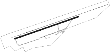
Runway info
| Runway 07 / 25 | ||
| length | 571m (1873ft) | |
| bearing | 81° / 261° | |
| width | 10m (33ft) | |
| surface | asphalt | |
| displ threshold | 41m (135ft) / 43m (141ft) | |
Nearby beacons
| code | identifier | dist | bearing | frequency |
|---|---|---|---|---|
| COL | COLA VOR/DME | 13.2 | 345° | 108.80 |
| SLD | DME | 18.2 | 72° | 108.05 |
| SIL | SIEGERLAND NDB | 19.6 | 77° | 489 |
| LV | COLOGNE-BONN NDB | 21.2 | 300° | 327 |
| LW | COLOGNE-BONN NDB | 25 | 310° | 300 |
| KBO | COLOGNE-BONN VOR/DME | 26.2 | 300° | 112.15 |
| TAU | TAUNUS VOR/DME | 27.1 | 122° | 113.35 |
| LJ | COLOGNE-BONN NDB | 31.2 | 301° | 365 |
| BUE | BUECHEL TACAN | 32.2 | 236° | 117.10 |
| WYP | WIPPER VOR | 32.2 | 322° | 109.60 |
| GMH | GERMINGHAUSEN VOR/DME | 37.3 | 22° | 115.40 |
| HAN | HAHN NDB | 38.8 | 212° | 376 |
| WIB | WIESBADEN TACAN | 40.1 | 128° | 114.10 |
| FHH | DME | 40.4 | 212° | 117.35 |
| WNN | DME | 40.7 | 285° | 109.85 |
| FW | FRANKFURT NDB | 44.9 | 126° | 382 |
| FRD | DME | 47.6 | 120° | 115.90 |
| VFM | NAUHEIM VOR | 47.9 | 126° | 113.75 |
| FFM | FRANKFURT VORTAC | 48.6 | 118° | 114.20 |
| BAM | BARMEN VOR/DME | 49.1 | 328° | 114 |
| SPA | SPANGDAHLEM TACAN | 50.9 | 238° | 109.50 |
| DUS | DUESSELDORF VOR/DME | 54.9 | 309° | 115.15 |
| LI | DUESSELDORF NDB | 55 | 316° | 417 |
| DY | DUESSELDORF NDB | 55.1 | 304° | 284 |
| DOR | WICKEDE (DORTMUND) VOR/DME | 57.6 | 359° | 108.65 |
| DWI | DORTMUND-WICKEDE NDB | 57.6 | 359° | 357 |
| RID | RIED VOR/DME | 58.1 | 131° | 112.20 |
Disclaimer
The information on this website is not for real aviation. Use this data with the X-Plane flight simulator only! Data taken with kind consent from X-Plane 12 source code and data files. Content is subject to change without notice.