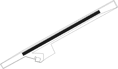
Binningen
Airport details
| Country | Germany |
| State | Baden-Württemberg |
| Region | ED |
| Airspace | Switzerland Ctr |
| Municipality | Hilzingen |
| Elevation | 1594ft (486m) |
| Timezone | GMT +1 |
| Coordinates | 47.79917, 8.72050 |
| Magnetic var | |
| Type | land |
| Available since | X-Plane v10.40 |
| ICAO code | EDSI |
| IATA code | n/a |
| FAA code | n/a |
Communication
| Binningen Binningen Info | 130.600 |
Nearby Points of Interest:
house to the Hirzen
-Katholisches Pfarrhaus Engen
-Weier, neolithic shore settlement
-Jüdischer Friedhof Randegg
-St. Peter und Paul
-Jüdischer Friedhof
-Konzernarchiv der Georg Fischer AG
-Werksiedlung Stahlwerkstrasse
-Burg Unterhof
-Haus zum Goldenen Leuen
-Giesserei +GF+, Werk I
-Bachschulhaus
-Rheinbrücke Feuerthalen
-Ochseschüür
-Schweizerhof
-Diessenhofen
-Grosses Haus
-Kaufleutstube (Schaffhausen)
-Haus zum Ritter
-Schaffhausen
-Rathaus (Schaffhausen)
-Kloster Allerheiligen Schaffhausen
-Eisenbibliothek
-Hallen für Neue Kunst
-Klosterkirche St. Michael
Nearby beacons
| code | identifier | dist | bearing | frequency |
|---|---|---|---|---|
| ZUE | ZURICH EAST VOR/DME | 13 | 155° | 110.05 |
| TRA | DME | 13.2 | 249° | 114.30 |
| KLO | KLOTEN (ZURICH) VOR/DME | 21.7 | 207° | 114.85 |
| FHD | DME | 32.6 | 100° | 112.60 |
| SUL | SULZ VOR | 35.1 | 353° | 116.10 |
| LHR | LAHR NDB | 49.2 | 301° | 337 |
| LRD | DME | 49.3 | 302° | 108.05 |
| WIL | WILLISAU VOR/DME | 49.8 | 233° | 116.90 |
| TGO | TANGO TACAN | 53.7 | 33° | 112.50 |
| SGD | DME | 57 | 30° | 115.45 |
| STG | STUTTGART VOR/DME | 57.9 | 31° | 116.85 |
| KBD | DME | 64.1 | 327° | 115.80 |
| KBA | KARLSRUHE/BADEN-BADEN NDB | 64.9 | 328° | 431 |
Disclaimer
The information on this website is not for real aviation. Use this data with the X-Plane flight simulator only! Data taken with kind consent from X-Plane 12 source code and data files. Content is subject to change without notice.