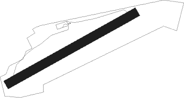
Wildberg - Wächtersberg
Airport details
| Country | Germany |
| State | Baden-Württemberg |
| Region | ED |
| Airspace | Langen Ctr |
| Municipality | Wildberg |
| Elevation | 1960ft (597m) |
| Timezone | GMT +1 |
| Coordinates | 48.61517, 8.75567 |
| Magnetic var | |
| Type | land |
| Available since | X-Plane v10.40 |
| ICAO code | EDSV |
| IATA code | n/a |
| FAA code | n/a |
Communication
| Wächtersberg Wächtersberg Info | 123.475 |
Nearby Points of Interest:
Wasserkraftwerk Nagold
-Aufbaugymnasium Nagold
-Spitalkirche Herrenberg
-Schloss Gärtringen
-Burg Rohrau
-Karmelitenkloster Rottenburg
-St. Moriz
-Gartenhalle
-Kornhaus
-Hölzersee
-Thiepval-Kaserne
-Schwabenhaus
-Gasthaus Rössle (Trillfingen)
-Eiermann campus
-Category:St Anna Church (Haigerloch)
-Universitätssternwarte Pfaffenwald
-Kollmar & Jourdan House
-Herrenalb Abbey
-Industriehaus Pforzheim
-Ehemaliges Bezirksamt, Bahnhofstraße 22–26, Pforzheim
-Pfarrhaus
-Altes Rathaus
-Glemsmühle
-Schwabtunnel
-Gutenhalde
Nearby beacons
| code | identifier | dist | bearing | frequency |
|---|---|---|---|---|
| SUL | SULZ VOR | 14.7 | 205° | 116.10 |
| SGD | DME | 19 | 81° | 115.45 |
| TGO | TANGO TACAN | 19.9 | 90° | 112.50 |
| STG | STUTTGART VOR/DME | 20.4 | 81° | 116.85 |
| KRH | KARLSRUHE VOR/DME | 23.6 | 336° | 115.95 |
| KBA | KARLSRUHE/BADEN-BADEN NDB | 28.2 | 286° | 431 |
| KBD | DME | 28.2 | 284° | 115.80 |
| LBU | LUBURG VOR/DME | 29.2 | 63° | 109.20 |
| LRD | DME | 39.9 | 255° | 108.05 |
| LHR | LAHR NDB | 40.8 | 254° | 337 |
| NKR | NECKAR NDB | 43.3 | 358° | 292 |
| MND | DME | 52.2 | 344° | 113.55 |
| TRA | DME | 57 | 199° | 114.30 |
| FHD | DME | 64.3 | 142° | 112.60 |
Disclaimer
The information on this website is not for real aviation. Use this data with the X-Plane flight simulator only! Data taken with kind consent from X-Plane 12 source code and data files. Content is subject to change without notice.