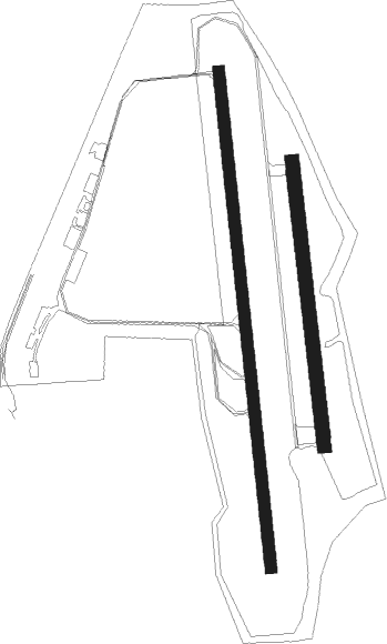
Donaueschingen - Donaueschingen-villingen
Airport details
| Country | Germany |
| State | Baden-Württemberg |
| Region | ED |
| Airspace | Langen Ctr |
| Municipality | Donaueschingen |
| Elevation | 2229ft (679m) |
| Timezone | GMT +1 |
| Coordinates | 47.97352, 8.52211 |
| Magnetic var | |
| Type | land |
| Available since | X-Plane v10.35 |
| ICAO code | EDTD |
| IATA code | ZQL |
| FAA code | n/a |
Communication
| Donaueschingen-Villingen Donaueschingen INFO | 126.690 |
Nearby beacons
| code | identifier | dist | bearing | frequency |
|---|---|---|---|---|
| TRA | DME | 17.3 | 197° | 114.30 |
| SUL | SULZ VOR | 24.9 | 17° | 116.10 |
| ZUE | ZURICH EAST VOR/DME | 25.8 | 142° | 110.05 |
| KLO | KLOTEN (ZURICH) VOR/DME | 31 | 177° | 114.85 |
| LHR | LAHR NDB | 36.3 | 298° | 337 |
| LRD | DME | 36.3 | 299° | 108.05 |
| FHD | DME | 43.6 | 107° | 112.60 |
| HOC | DME | 46 | 239° | 113.20 |
| BS | BASLE-MULHOUSE NDB | 46.2 | 248° | 376 |
| TGO | TANGO TACAN | 48.6 | 49° | 112.50 |
| SE | STRASBOURG NDB | 49 | 307° | 412 |
| STR | STRASBOURG ENTZHEIM VOR/DME | 49.6 | 299° | 115.60 |
| SGD | DME | 51.2 | 44° | 115.45 |
| KBD | DME | 51.4 | 332° | 115.80 |
| KBA | KARLSRUHE/BADEN-BADEN NDB | 52.3 | 333° | 431 |
| STG | STUTTGART VOR/DME | 52.3 | 45° | 116.85 |
| WIL | WILLISAU VOR/DME | 53.8 | 218° | 116.90 |
| LBU | LUBURG VOR/DME | 65.1 | 41° | 109.20 |
Departure and arrival routes
| Transition altitude | 5000ft |
| SID end points | distance | outbound heading | |
|---|---|---|---|
| RW18 | |||
| NEDO3S | 17mi | 87° | |
| TRA3S | 17mi | 197° | |
| MOPA3S | 22mi | 307° | |
| RW36 | |||
| NEDO3N | 17mi | 87° | |
| TRA3N | 17mi | 197° | |
| MOPA3N | 22mi | 307° | |
| STAR starting points | distance | inbound heading | |
|---|---|---|---|
| RW36 | |||
| TRA3D | 17.3 | 17° | |
| NATO4D | 14.2 | 134° | |
| EMKI2D | 15.4 | 230° | |
Instrument approach procedures
| runway | airway (heading) | route (dist, bearing) |
|---|---|---|
| RW36 | DONET (357°) | DONET TD001 (8mi, 221°) 6000ft TD002 (4mi, 178°) 6000ft TD003 (4mi, 89°) 5000ft |
| RW36 | TRA (17°) | TRA TD003 (7mi, 44°) 5000ft |
| RNAV | TD003 5000ft VIBEV (4mi, 358°) 4500ft EDTD (7mi, 358°) 2269ft (2915mi, 190°) 2640ft TD004 (2920mi, 10°) TD004 (turn) 4000ft TD005 (3mi, 256°) DONET (6mi, 134°) 6000ft |
Holding patterns
| STAR name | hold at | type | turn | heading* | altitude | leg | speed limit |
|---|---|---|---|---|---|---|---|
| EMKI2D | DONET | VHF | right | 10 (190)° | > 6000ft | 1.0min timed | ICAO rules |
| NATO4D | DONET | VHF | right | 10 (190)° | > 6000ft | 1.0min timed | ICAO rules |
| TRA3D | DONET | VHF | right | 10 (190)° | > 6000ft | 1.0min timed | ICAO rules |
| *) magnetic outbound (inbound) holding course | |||||||
Disclaimer
The information on this website is not for real aviation. Use this data with the X-Plane flight simulator only! Data taken with kind consent from X-Plane 12 source code and data files. Content is subject to change without notice.

