Mengen - Mengen - Hohentengen
Airport details
| Country | Germany |
| State | Baden-Württemberg |
| Region | ED |
| Airspace | Langen Ctr |
| Municipality | Hohentengen |
| Elevation | 1816ft (554m) |
| Timezone | GMT +1 |
| Coordinates | 48.05389, 9.37278 |
| Magnetic var | |
| Type | land |
| Available since | X-Plane v10.40 |
| ICAO code | EDTM |
| IATA code | n/a |
| FAA code | n/a |
Communication
| Mengen - Hohentengen Mengen Info | 122.375 |
Nearby Points of Interest:
Sandgrube Gertenstock
-Villa rustica of Laucherthal
-Kloster Heiligkreuztal
-Villa rustica of Inzigkofen
-St. Georg (Hailtingen)
-Felsentäle
-Jewish cemetery, Bad Buchau
-Liebfrauenkapelle
-Schussenried Abbey
-Villa rustica of Meßkirch
-Ruin Hohenbodman
-Buchheimer Hans
-Gigelberghalle
-Roter Bau
-Speidlerhaus
-Feuchtmayer Museum
-Unserer lieben Frau auf dem Kapf
-Blasiuskapelle in Briach
-Pfarrkirche St. Jodok
-Altes Theater
-Landgericht Ravensburg
-Amtsgericht Ravensburg
-Salmannsweiler Hof (Überlingen)
-Sebastianskapelle (Mühlheim an der Donau)
-Rathaus (Mühlheim an der Donau)
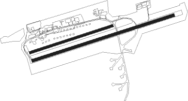
Runway info
Runway 08 / 26  | ||
| length | 1562m (5125ft) | |
| bearing | 81° / 261° | |
| width | 30m (98ft) | |
| surface | asphalt | |
| displ threshold | 300m (984ft) / 0m (0ft) | |
| blast zone | 0m (0ft) / 97m (318ft) | |
| Runway 07 / 25 | ||
| length | 909m (2982ft) | |
| bearing | 81° / 261° | |
| width | 25m (82ft) | |
| surface | grass | |
Nearby beacons
| code | identifier | dist | bearing | frequency |
|---|---|---|---|---|
| LUP | LAUPHEIM NDB | 23.7 | 73° | 407 |
| FHD | DME | 23.8 | 161° | 112.60 |
| TGO | TANGO TACAN | 34.2 | 349° | 112.50 |
| ALD | (MEMMINGEN/ALLGAU) DME | 34.7 | 94° | 117.20 |
| SUL | SULZ VOR | 35.1 | 294° | 116.10 |
| ZUE | ZURICH EAST VOR/DME | 35.6 | 230° | 110.05 |
| ALG | ALLGAEU (MEMMINGEN) NDB | 35.8 | 94° | 341 |
| SGD | DME | 38.5 | 347° | 115.45 |
| STG | STUTTGART VOR/DME | 38.8 | 350° | 116.85 |
| KPT | KEMPTEN VOR/DME | 43.4 | 108° | 108.40 |
| TRA | DME | 43.5 | 249° | 114.30 |
| KLO | KLOTEN (ZURICH) VOR/DME | 48.9 | 234° | 114.85 |
| LBU | LUBURG VOR/DME | 51.6 | 358° | 109.20 |
| KRH | KARLSRUHE VOR/DME | 64.5 | 320° | 115.95 |
Departure and arrival routes
| Transition altitude | 5000ft |
| SID end points | distance | outbound heading | |
|---|---|---|---|
| RW07 | |||
| TINO5E | 16mi | 228° | |
| LEBS4E | 14mi | 317° | |
| RW25 | |||
| TINO4W | 16mi | 228° | |
| LEBS4W | 14mi | 317° | |
Instrument approach procedures
| runway | airway (heading) | route (dist, bearing) |
|---|---|---|
| RW25 | ARSUT (159°) | ARSUT 6000ft TM431 (3mi, 95°) 6000ft TM430 (7mi, 95°) 5000ft TM420 (4mi, 161°) 4000ft |
| RW25 | RAVED (318°) | RAVED 6000ft TM451 (17mi, 8°) 6000ft TM450 (4mi, 341°) 5000ft TM420 (4mi, 283°) 4000ft |
| RNAV | TM420 4000ft TETGU (3mi, 261°) 3500ft EDTM (6mi, 261°) 1860ft TM415 (5mi, 261°) 3500ft TM410 (3mi, 139°) TM405 (4mi, 54°) ARSUT (8mi, 352°) 6000ft |
Disclaimer
The information on this website is not for real aviation. Use this data with the X-Plane flight simulator only! Data taken with kind consent from X-Plane 12 source code and data files. Content is subject to change without notice.