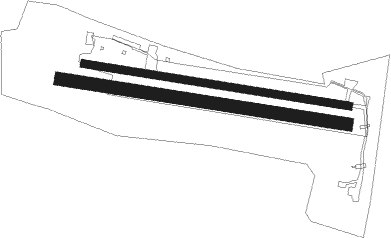
Pattonville
Airport details
| Country | Germany |
| State | Baden-Württemberg |
| Region | ED |
| Airspace | Langen Ctr |
| Municipality | Stuttgart |
| Elevation | 924ft (282m) |
| Timezone | GMT +1 |
| Coordinates | 48.86488, 9.22040 |
| Magnetic var | |
| Type | land |
| Available since | X-Plane v10.40 |
| ICAO code | EDTQ |
| IATA code | n/a |
| FAA code | n/a |
Communication
| Pattonville Pattonville Info | 124.610 |
Nearby Points of Interest:
Olgastraße 5
-Salamander-Areal
-Villa Feyerabend
-Leonberger Straße 17
-Franckstraße 2 und 4
-Franckstraße 5
-Musikhalle Ludwigsburg
-Pflugfelder Straße 20
-Pflugfelder Straße 5
-Marktbrunnen
-Waldhorn
-Schloss Stammheim
-Bürogebäude der ehemaligen Spinnerei Horkheimer
-Monrepos
-Artemis-Selene-Relief
-Festhalle
-City Archive Stuttgart
-Altes Pfarrhaus
-Funkhaus Stuttgart
-Villa Kahn
-Hindenburgbau
-Tiergarten Nill
-Wirtemberg Castle
-Württemberg Mausoleum
-Metropol

Nearby beacons
| code | identifier | dist | bearing | frequency |
|---|---|---|---|---|
| LBU | LUBURG VOR/DME | 5.5 | 68° | 109.20 |
| STG | STUTTGART VOR/DME | 10.2 | 168° | 116.85 |
| SGD | DME | 10.6 | 179° | 115.45 |
| TGO | TANGO TACAN | 14.8 | 171° | 112.50 |
| KRH | KARLSRUHE VOR/DME | 26.2 | 281° | 115.95 |
| SHD | HALL DME | 26.6 | 66° | 108.05 |
| NKR | NECKAR NDB | 34.2 | 314° | 292 |
| SUL | SULZ VOR | 36.9 | 230° | 116.10 |
| NDD | DME-ILS | 43 | 54° | 108.70 |
| NSN | NIEDERSTETTEN NDB | 43.2 | 55° | 311 |
| MND | DME | 45.7 | 311° | 113.55 |
| LUP | LAUPHEIM NDB | 47.5 | 133° | 407 |
| RID | RIED VOR/DME | 61.1 | 323° | 112.20 |
Disclaimer
The information on this website is not for real aviation. Use this data with the X-Plane flight simulator only! Data taken with kind consent from X-Plane 12 source code and data files. Content is subject to change without notice.