Airports for X-Plane offers a convenient way to explore airports and their related communication information for the X-Plane flight simulator. It only uses data from the X-Plane flight simulator itself, and is therefore more reliable than the data that comes from real aviation websites. You can search for airports by using the ICAO code, or browse for airports per country and state. The information displayed is categorized by airport details, runway information, airport communication, approach frequencies (ILS and Glidepath details), details of nearby beacons, SIDs, STARs and approach procedures.

airdrome control tower embassy terminal customs air terminal corporation taxiway stolport stol bus kennedy airport authority plane stopover transit drome takeoff air safety gravel

Stechow-ferchesar

Airport details

CountryGermany
StateBrandenburg
RegionED
AirspaceBremen Ctr
MunicipalityNennhausen
Elevation146ft (45m)
TimezoneGMT +1
Coordinates52.65055, 12.48778
Magnetic var
Typeland
Available sinceX-Plane v10.40
ICAO codeEDUA
IATA coden/a
FAA coden/a

Communication

Stechow-Ferchesar Stechow Info122.200
Nearby Points of Interest:
Dorfkirche Kotzen
-
Village church Kriele
-
Dorfkirche Buckow (Nennhausen)
-
Rathenower Refraktor
-
Dorfkirche Kleßen
-
Dorfkirche Wagenitz
-
Village church Garlitz (Havelland)
-
Dorfkirche Spaatz
-
Village church Paulinenaue
-
Gehöft Mühlenstraße 4
-
Pfarrhaus Hohenferchesar
-
Wohnhaus Dammstraße 18
-
Gehöft Dammstraße 20
-
Pfarrgehöft Marktstraße 6
-
Gehöft Havelstraße 8
-
Dorfkirche Ribbeck
-
Wohnhaus Dorfstraße 12
-
Gehöft Fohrder Hauptstraße 7
-
Villa Reichstein
-
Wohnhaus Dorfstraße 8
-
Gehöft Alte Tieckower Straße 5
-
Pfarrgehöft Dorfstraße 31
-
Kirchen- und Schulhaus Tieckow
-
Gehöft Dorfstraße 29
-
Gehöft Unter den Linden 11

Runway info

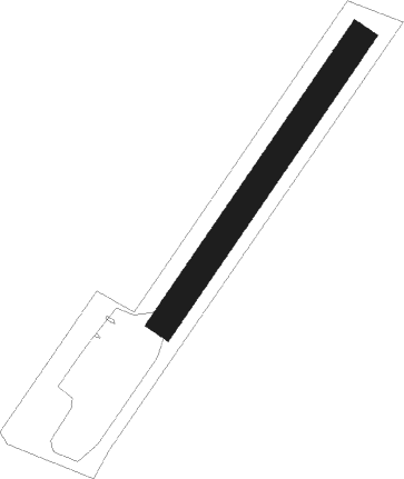
Runway 04 / 22
 length490m (1608ft)
 bearing53° / 233°
 width40m (131ft)
 surfacegrass

Airport layout


Nearby beacons

codeidentifierdistbearingfrequency
LWBLOEWENBERG VOR/DME28.168°114.55
BBIBERLIN BRANDENBURG VOR/DME39.8108°114.10
BKDBRUENKENDORF VOR/DME41.2292°117.70
MAGMAGDEBURG VOR/DME46.8227°110.45
PMDDME52.9318°117.50
PISCHWERIN-PARCHIM NDB53324°333
PAHSCHWERIN-PARCHIM NDB53.6312°315
HOZHOLZDORF NDB57.4145°406
HOZHOLZDORF TACAN59.1141°117.25

Disclaimer

The information on this website is not for real aviation. Use this data with the X-Plane flight simulator only! Data taken with kind consent from X-Plane 12 source code and data files. Content is subject to change without notice.