Uebigau-wahrenbrück - Falkenberg - Lönnewitz
Airport details
| Country | Germany |
| State | Brandenburg |
| Region | ED |
| Airspace | Bremen Ctr |
| Municipality | Mühlberg/Elbe |
| Elevation | 284ft (87m) |
| Timezone | GMT +1 |
| Coordinates | 51.54974, 13.23711 |
| Magnetic var | |
| Type | land |
| Available since | X-Plane v10.40 |
| ICAO code | EDUF |
| IATA code | n/a |
| FAA code | n/a |
Communication
| Falkenberg - Lönnewitz Loennewitz Info | 130.125 |
Nearby Points of Interest:
Dorfkirche Alt Lönnewitz
-Wohnstallhaus
-Wohnhaus Lindenstraße 28 (Rehfeld)
-Dorfkirche Altbelgern
-Stadtkirche Wahrenbrück
-Dorfkirche (Langennaundorf)
-Alter Gasthof Löhsten
-Wohnhaus Kleinrössen 6 (Kleinrössen)
-Windmühle Drasdo
-Roland statue of Belgern
-Dorfkirche Drasdo
-Rosmaringasse 4
-Wegweiser Berliner Straße 8 (Bad Liebenwerda)
-Kaiserliches Postamt (Bad Liebenwerda)
-Dorfkirche
-Rittergut Prestewitz
-Village church Kosilenzien
-Dorfkirche Buckau
-Village church Oschätzchen
-Village school Zeischa
-Evangelical Church Tröbitz
-Grabmal des Elias Borßdorff
-Village church Kröbeln
-Jagdhaus Dobra (Bad Liebenwerda)
-Dovecot Dobra
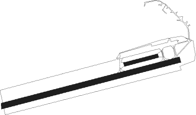
Runway info
Runway 08 / 26  | ||
| length | 1197m (3927ft) | |
| bearing | 84° / 264° | |
| width | 30m (98ft) | |
| surface | concrete | |
| Runway 08L / 26R | ||
| length | 362m (1188ft) | |
| bearing | 84° / 264° | |
| width | 40m (131ft) | |
| surface | grass | |
| Runway 08C / 26C | ||
| length | 2077m (6814ft) | |
| bearing | 84° / 264° | |
| width | 60m (197ft) | |
| surface | concrete | |
| blast zone | 255m (837ft) / 0m (0ft) | |
Nearby beacons
| code | identifier | dist | bearing | frequency |
|---|---|---|---|---|
| HOZ | HOLZDORF TACAN | 13.1 | 350° | 117.25 |
| HOZ | HOLZDORF NDB | 14.2 | 328° | 406 |
| LEG | LEIPZIG VOR/DME | 29.3 | 262° | 115.85 |
| KLF | KLASDORF VOR/DME | 30.6 | 35° | 115.15 |
| FS | DRESDEN NDB | 31.4 | 120° | 374 |
| DND | DME | 31.9 | 129° | 115.40 |
| DRN | DRESDEN VOR/DME | 34.8 | 146° | 114.35 |
| ZIG | LEIPZIG NDB | 36.4 | 263° | 340 |
| SKZ | SCHKEUDITZ (LEIPZIG-HALLE) NDB | 37 | 262° | 357 |
| ABU | ALTENBURG NDB | 42.8 | 232° | 330 |
| AGD | DME | 43.6 | 232° | 115.30 |
| BBI | BERLIN BRANDENBURG VOR/DME | 48.2 | 15° | 114.10 |
| SDD | DME | 50.5 | 18° | 114.40 |
| FWE | FUERSTENWALDE VOR/DME | 61.3 | 46° | 113.30 |
Disclaimer
The information on this website is not for real aviation. Use this data with the X-Plane flight simulator only! Data taken with kind consent from X-Plane 12 source code and data files. Content is subject to change without notice.