Airports for X-Plane offers a convenient way to explore airports and their related communication information for the X-Plane flight simulator. It only uses data from the X-Plane flight simulator itself, and is therefore more reliable than the data that comes from real aviation websites. You can search for airports by using the ICAO code, or browse for airports per country and state. The information displayed is categorized by airport details, runway information, airport communication, approach frequencies (ILS and Glidepath details), details of nearby beacons, SIDs, STARs and approach procedures.

hangar propeller plane airports hotel airfield arriving aviation port airliner regional airport check-in aerodromes warfare aircraft commuter station government air safety passengers drome

Finsterwalde - Finsterwalde - Schacksdorf

Airport details

CountryGermany
StateBrandenburg
RegionED
AirspaceBremen Ctr
MunicipalityLichterfeld-Schacksdorf
Elevation397ft (121m)
TimezoneGMT +1
Coordinates51.60750, 13.73800
Magnetic var
Typeland
Available sinceX-Plane v10.40
ICAO codeEDUS
IATA coden/a
FAA coden/a

Communication

Finsterwalde - Schacksdorf Schacksdorf Info123.050
Nearby Points of Interest:
Dorfkirche Betten
-
Stadtpfarrkirche St. Trinitatis
-
Dorfkirche Massen (Niederlausitz)
-
Protestant Church Lieskau
-
Dorfkirche Sallgast
-
Dorfkirche Göllnitz
-
Münchhausen church
-
Paltrockwindmühle Oppelhain
-
St. Pantaleon
-
Dorfkirche Wormlage
-
Dorfkirche Oppelhain
-
Herz-Jesu-Kirche in Klettwitz
-
Friedensgedächtniskirche
-
Schwert
-
Rathaus (Doberlug-Kirchhain)
-
Schachtanlage Klettwitz
-
Stadtpfarrkirche
-
Christus-König-Kirche (Lauchhammer)
-
Rautenstock
-
Dorfkirche Lindena
-
Village church Bronkow
-
Henrietten-Kirche
-
Dorfkirche Rückersdorf
-
Grundschule Lauchhammer-Süd
-
Dorfkirche Groß Mehßow

Runway info

Runway 09 / 27  
 length1489m (4885ft)
 bearing89° / 269°
 width30m (98ft)
 surfaceconcrete
 displ threshold148m (486ft) / 149m (489ft)
Runway 09R / 27L  
 length852m (2795ft)
 bearing89° / 269°
 width40m (131ft)
 surfacegrass

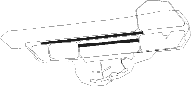
Airport layout


Parking locations

Nearby beacons

codeidentifierdistbearingfrequency
HOZHOLZDORF TACAN22.2286°117.25
FSDRESDEN NDB25.2165°374
KLFKLASDORF VOR/DME25.5337°115.15
HOZHOLZDORF NDB25.7284°406
DNDDME28.7178°115.40
DRNDRESDEN VOR/DME35.9193°114.35
BBIBERLIN BRANDENBURG VOR/DME45.3339°114.10
SDDDME46.8343°114.40
HDOHERMSDORF VOR/DME47.1137°108.65
FWEFUERSTENWALDE VOR/DME50.426°113.30

Disclaimer

The information on this website is not for real aviation. Use this data with the X-Plane flight simulator only! Data taken with kind consent from X-Plane 12 source code and data files. Content is subject to change without notice.