Blomberg - Blomberg-borkhausen
Airport details
| Country | Germany |
| State | North Rhine-Westphalia |
| Region | ED |
| Airspace | Bremen Ctr |
| Municipality | Blomberg |
| Elevation | 534ft (163m) |
| Timezone | GMT +1 |
| Coordinates | 51.91800, 9.11333 |
| Magnetic var | |
| Type | land |
| Available since | X-Plane v10.40 |
| ICAO code | EDVF |
| IATA code | n/a |
| FAA code | n/a |
Communication
| Blomberg-Borkhausen Borkhausen Info | 119.825 |
Nearby Points of Interest:
Synagoge (Blomberg)
-Rathaus Blomberg
-Bauernburg Ottenhausen
-Gut Grevenburg
-St. Jakobus d. Ä. und Christophorus
-Rathaus Nieheim
-Amtsgericht Horn
-Hünenburg
-Steinkuhlenstraße 30 (Detmold)
-Jewish cemetery, Vörden, Marienmünster
-Falkenkrug
-Städtische Gewerbeschule Detmold
-Arbeitsgericht Detmold
-Sozialgericht Detmold
-Lippe State Library at Detmold
-Haus Münsterberg
-Leopoldstraße 5
-Mariä Himmelfahrt
-Fachwerksynagoge
-Exterstraße 8
-Rathaus Detmold
-Kaufhaus Sonntag
-Krumme Straße 2
-Lange Straße 14 (Detmold)
-Wehmhof
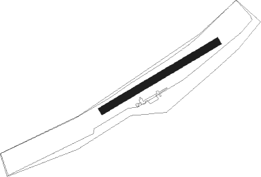
Runway info
| Runway 06 / 24 | ||
| length | 528m (1732ft) | |
| bearing | 73° / 253° | |
| width | 30m (98ft) | |
| surface | grass | |
Nearby beacons
| code | identifier | dist | bearing | frequency |
|---|---|---|---|---|
| BYC | BUECKEBURG NDB | 22.4 | 357° | 368 |
| WRB | WARBURG VOR/DME | 24.7 | 180° | 113.70 |
| PAD | PADERBORN-LIPPSTADT NDB | 24.9 | 238° | 354 |
| PAD | DME-ILS | 26 | 238° | 108.50 |
| DKS | DME-ILS | 31.7 | 150° | 111.50 |
| WUN | WUNSTORF TACAN | 34.2 | 30° | 114.85 |
| DLE | LEINE VOR/DME | 34.7 | 67° | 115.20 |
| SAS | SARSTEDT VOR/DME | 34.7 | 67° | 114.45 |
| OSB | OSNABRUCK TACAN | 34.9 | 289° | 108.35 |
| OSN | OSNABRUECK VOR | 34.9 | 289° | 114.30 |
| HW | HANNOVER NDB | 36.7 | 38° | 358 |
| HBD | DME | 38 | 45° | 116.90 |
| HAD | DME | 39.4 | 47° | 113.95 |
| HA | HANNOVER NDB | 41.5 | 52° | 320 |
| NIE | NIENBURG VOR | 43.5 | 20° | 116.50 |
| DP | DIEPHOLZ NDB | 47.1 | 316° | 325 |
| FTZ | FRITZLAR NDB | 51.3 | 160° | 468 |
| CEL | CELLE NDB | 52.5 | 54° | 311 |
Disclaimer
The information on this website is not for real aviation. Use this data with the X-Plane flight simulator only! Data taken with kind consent from X-Plane 12 source code and data files. Content is subject to change without notice.