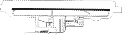
Kassel - Kassel-calden
Airport details
| Country | Germany |
| State | Hesse |
| Region | ED |
| Airspace | Bremen Ctr |
| Municipality | Schachten |
| Elevation | 859ft (262m) |
| Timezone | GMT +1 |
| Coordinates | 51.42079, 9.39216 |
| Magnetic var | |
| Type | land |
| Available since | X-Plane v10.40 |
| ICAO code | EDVK |
| IATA code | KSF |
| FAA code | n/a |
Communication
| Kassel-Calden Kassel ATIS | 129.205 |
| Kassel-Calden Kassel Ground | 121.905 |
| Kassel-Calden Kassel Tower | 118.105 |
| Kassel-Calden BREMEN RADAR | 126.655 |
Approach frequencies
| ILS-cat-III | RW27 | 109.3 | 18.00mi |
| ILS-cat-I | RW09 | 108.1 | 18.00mi |
| 3° GS | RW09 | 108.1 | 18.00mi |
| 3° GS | RW27 | 109.3 | 18.00mi |
Nearby Points of Interest:
Galeriegrab Calden I
-Evangelische Kirche Meimbressen
-Evangelische Kirche Carlsdorf
-Steinernes Haus (Hofgeismar)
-Petriplatz 2 (Hofgeismar)
-Elfbuchenturm
-St. Johannis Holzhausen
-Bahnhof Liebenau
-Stadthalle Kassel
-Dörnbergstraße 2 (Kassel)
-Wilhelmshöher Allee 118
-Gräfestraße 16
-Ständehaus Kassel
-Henschelhaus
-Evangelische Kirche Hümme
-Palais Reichenbach
-Ev. Garnisonskirche
-Zwehrenturm
-Haus Marställer Platz 7
-Elisabethhospital (Kassel)
-Karlshospital
-Frühstückspavillon
-Eulenturm
-Kapelle Bonaforth
-Austermühle
Nearby beacons
| code | identifier | dist | bearing | frequency |
|---|---|---|---|---|
| DKS | DME-ILS | 0.4 | 88° | 111.50 |
| WRB | WARBURG VOR/DME | 11.6 | 287° | 113.70 |
| FTZ | FRITZLAR NDB | 20.2 | 176° | 468 |
| PAD | PADERBORN-LIPPSTADT NDB | 30.6 | 285° | 354 |
| PAD | DME-ILS | 31 | 284° | 108.50 |
| FUL | FULDA VOR/DME | 50.2 | 168° | 112.10 |
| DLE | LEINE VOR/DME | 53 | 31° | 115.20 |
| SAS | SARSTEDT VOR/DME | 53 | 31° | 114.45 |
| BYC | BUECKEBURG NDB | 53.4 | 341° | 368 |
Departure and arrival routes
| Transition altitude | 5000ft |
| SID end points | distance | outbound heading | |
|---|---|---|---|
| RW09 | |||
| LUXU1M | 19mi | 60° | |
| WERA1M | 13mi | 82° | |
| ELNA1M | 17mi | 126° | |
| XARO1M | 14mi | 253° | |
| WRB2M | 12mi | 287° | |
| RW27 | |||
| LUXU2N | 19mi | 60° | |
| WERA7N | 13mi | 82° | |
| ELNA4N | 17mi | 126° | |
| XARO2N | 14mi | 253° | |
| WRB9N | 12mi | 287° | |
Instrument approach procedures
| runway | airway (heading) | route (dist, bearing) |
|---|---|---|
| RW09 | ELNAT (306°) | ELNAT XAROL (25mi, 280°) 5000ft VK110 (5mi, 280°) 5000ft VK111 (7mi, 7°) 5000ft VK120 (4mi, 93°) 3500ft |
| RW09 | LUXUX (240°) | LUXUX VK112 (18mi, 259°) 5000ft WRB (7mi, 259°) 3500ft VK113 (2mi, 259°) 3500ft VK120 (3mi, 187°) 3500ft |
| RW09 | WRB (107°) | WRB VK113 (2mi, 259°) 3500ft VK120 (3mi, 187°) 3500ft |
| RW09 | XAROL (73°) | XAROL VK110 (5mi, 280°) 5000ft VK111 (7mi, 7°) 5000ft VK120 (4mi, 93°) 3500ft |
| RNAV | VK120 3500ft ABLIB (4mi, 93°) 3500ft EDVK (9mi, 93°) 910ft VK130 (3mi, 93°) VK131 (3mi, 52°) VK132 (5mi, 332°) WRB (14mi, 266°) 4000ft | |
| RW27 | ELNAT (306°) | ELNAT VK141 (7mi, 348°) 4000ft VK150 (5mi, 348°) 3000ft |
| RW27 | LUXUX (240°) | LUXUX VK142 (7mi, 214°) 4000ft VK143 (3mi, 214°) 3000ft VK150 (4mi, 188°) 3000ft |
| RW27 | WRB (107°) | WRB VK143 (21mi, 93°) 3000ft VK150 (4mi, 188°) 3000ft |
| RW27 | XAROL (73°) | XAROL VK100 (18mi, 92°) 5000ft VK141 (5mi, 80°) 3000ft VK150 (5mi, 348°) 3000ft |
| RNAV | VK150 3000ft LALTU (4mi, 273°) 2500ft EDVK (6mi, 273°) 852ft VK160 (6mi, 273°) WRB (7mi, 300°) 4000ft |
Disclaimer
The information on this website is not for real aviation. Use this data with the X-Plane flight simulator only! Data taken with kind consent from X-Plane 12 source code and data files. Content is subject to change without notice.