Wagenhoff - Wilsche
Airport details
| Country | Germany |
| State | Lower Saxony |
| Region | ED |
| Airspace | Bremen Ctr |
| Municipality | Gifhorn |
| Elevation | 180ft (55m) |
| Timezone | GMT +1 |
| Coordinates | 52.52450, 10.46283 |
| Magnetic var | |
| Type | land |
| Available since | X-Plane v10.40 |
| ICAO code | EDVQ |
| IATA code | n/a |
| FAA code | n/a |
Communication
| Wilsche Wilsche Info | 129.975 |
Nearby Points of Interest:
Nikolaikirche
-St.-Sebastian-Kirche
-St. Georgs-Kirche
-Amtshof Eicklingen
-St. Marien-Kirche (Wienhausen)
-St. Marienkirche
-St. Joseph
-Saint Peter Church Stederdorf
-Stephanus-I-Kindergarten
-Alvar-Aalto-Kulturhaus
-Billen-Pavillon
-Georgskirche Eutzen
-Alte Dorfkirche
-St. Nicolaikirche
-Christophoruskirche in Sprakensehl
-Im Güldenen Winkel 8
-Amtshaus Vorsfelde
-Amtshof Vorsfelde
-Rathaus Vorsfelde
-Italienischer Garten
-Peine Castle
-Evangelische Dorfkirche Vöhrum
-Seeckt-Kaserne
-Wohnhausgruppe Waack
-Achtermannsches Haus
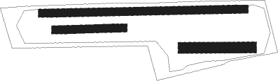
Runway info
Runway 09 / 27  | ||
| length | 751m (2464ft) | |
| bearing | 92° / 272° | |
| width | 30m (98ft) | |
| surface | grass | |
| displ threshold | 250m (820ft) / 0m (0ft) | |
| Runway 09R / 27L | ||
| length | 250m (820ft) | |
| bearing | 92° / 272° | |
| width | 30m (98ft) | |
| surface | grass | |
| Runway 10 / 28 | ||
| length | 250m (820ft) | |
| bearing | 93° / 273° | |
| width | 40m (131ft) | |
| surface | grass | |
Nearby beacons
| code | identifier | dist | bearing | frequency |
|---|---|---|---|---|
| BRU | BRAUNSCHWEIG-WOLFSBURG NDB | 13.2 | 145° | 427 |
| HLZ | HEHLINGEN VOR/DME | 15.5 | 116° | 117.30 |
| CEL | CELLE NDB | 16.2 | 279° | 311 |
| HA | HANNOVER NDB | 24.3 | 265° | 320 |
| FSB | FASSBERG NDB | 25.5 | 325° | 284 |
| DLE | LEINE VOR/DME | 26.8 | 245° | 115.20 |
| SAS | SARSTEDT VOR/DME | 26.8 | 245° | 114.45 |
| HAD | DME | 28.2 | 266° | 113.95 |
| HBD | DME | 29.6 | 265° | 116.90 |
| HW | HANNOVER NDB | 33.6 | 267° | 358 |
| CB | COCHSTEDT NDB | 53.9 | 124° | 344 |
Disclaimer
The information on this website is not for real aviation. Use this data with the X-Plane flight simulator only! Data taken with kind consent from X-Plane 12 source code and data files. Content is subject to change without notice.