Rinteln
Airport details
| Country | Germany |
| State | Lower Saxony |
| Region | ED |
| Airspace | Bremen Ctr |
| Municipality | Rinteln |
| Elevation | 180ft (55m) |
| Timezone | GMT +1 |
| Coordinates | 52.17528, 9.05333 |
| Magnetic var | |
| Type | land |
| Available since | X-Plane v10.40 |
| ICAO code | EDVR |
| IATA code | n/a |
| FAA code | n/a |
Communication
| Rinteln Rinteln Info | 122.925 |
Nearby Points of Interest:
Schloss Arensburg
-Erbpachtmühle Langenholzhausen
-Kalkofen Timmerberg
-Windmühle Bentorf
-house with mikwe
-Haus Malz
-Stadtvilla Noll
-Langer Jammer
-Stadtvilla Köhler
-Berliner Kilometerstein
-Alte Regierung Minden
-Windloch
-Bürgerschule III in Minden
-St Johannis
-Brüderhof Minden
-Old bridge of Wasserstraßenkreuz Minden
-Amtsgericht Bad Oeynhausen
-Rathaus
-Großsteingrab von Werste
-Ballhaus
-Altes Rathaus (Stadthagen)
-Schloss Brake
-Windmühlenstumpf
-Wasserbehälter
-Osterstraße 12
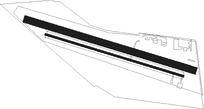
Runway info
Runway 11C / 29C  | ||
| length | 731m (2398ft) | |
| bearing | 103° / 283° | |
| width | 30m (98ft) | |
| surface | grass | |
| Runway 11 / 29 | ||
| length | 604m (1982ft) | |
| bearing | 103° / 283° | |
| width | 10m (33ft) | |
| surface | asphalt | |
Nearby beacons
| code | identifier | dist | bearing | frequency |
|---|---|---|---|---|
| BYC | BUECKEBURG NDB | 7 | 18° | 368 |
| WUN | WUNSTORF TACAN | 21.7 | 53° | 114.85 |
| HW | HANNOVER NDB | 25.2 | 59° | 358 |
| HBD | DME | 27.8 | 65° | 116.90 |
| OSB | OSNABRUCK TACAN | 28.3 | 272° | 108.35 |
| OSN | OSNABRUECK VOR | 28.3 | 272° | 114.30 |
| HAD | DME | 29.4 | 65° | 113.95 |
| NIE | NIENBURG VOR | 29.4 | 35° | 116.50 |
| DLE | LEINE VOR/DME | 30.8 | 85° | 115.20 |
| SAS | SARSTEDT VOR/DME | 30.9 | 85° | 114.45 |
| HA | HANNOVER NDB | 32.5 | 69° | 320 |
| DP | DIEPHOLZ NDB | 33.3 | 305° | 325 |
| PAD | PADERBORN-LIPPSTADT NDB | 36.5 | 217° | 354 |
| PAD | DME-ILS | 37.5 | 218° | 108.50 |
| WRB | WARBURG VOR/DME | 40.2 | 175° | 113.70 |
| CEL | CELLE NDB | 43.5 | 67° | 311 |
| DKS | DME-ILS | 47.1 | 155° | 111.50 |
| HIG | BREMEN NDB | 52.7 | 351° | 318 |
| BND | DME | 53.1 | 343° | 113.65 |
| BMN | BREMEN VOR/DME | 53.3 | 341° | 117.45 |
Disclaimer
The information on this website is not for real aviation. Use this data with the X-Plane flight simulator only! Data taken with kind consent from X-Plane 12 source code and data files. Content is subject to change without notice.